What are tidal datums? Learn about the most common in the world: LAT and MLLW
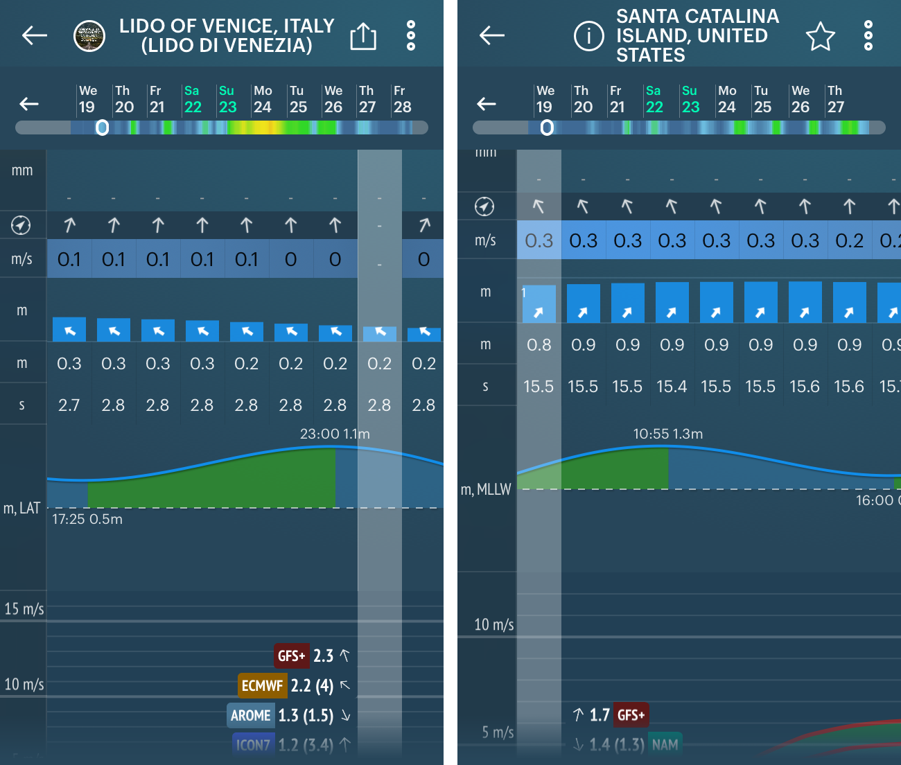
In Windy.app you can get information on tides from the two of most common datums in the world: LAT and MLLW. And tides are needed for everyone who do yachting, surfing, fishing at sea... Find out what tidal datums are and how to use them in the app.
What is tidal datum?
First, let's quickly and briefly understand the terminology of tides:
- Tides are caused by the gravity of the Moon and the Sun towards the Earth, as well as the rotation of the Earth itself.
- Tides occur in cycles because the Earth and the Moon rotate in a certain way — closer or further apart. And the Sun does not disappear anywhere.
- The maximum water level during a tidal cycle is called high water. It's when there's the most water.
- The minimum water level at low tide is called lower low water. This is when water is the smallest.
- Time passes between high water and low water. This is called the duration of the tide.
- Finally, the tidal cycle has an amplitude or "swing latitude" — like a pendulum. The amplitude of the tide is the difference between the levels of the adjacent high and low water.
Conclusion: water height fluctuates constantly. And if that's what happens, it has to be counted from something, right? It's got to be zero depth. In other words, the datum, what's taken for zero depth.
Ok, what are LAT and MLLW tidal datums and what’s the difference between them?
These are two of the most common datums in the world. So both are now in Windy.app.
1. LAT (Lowest Astronomical Tide) is the lowest theoretical water level.
It is taken as zero depths on Russian, British and other European maps. In general, it is common in Europe. It is predicted based on the lowest possible tide level in the history of observation over 19 years.
What does that mean? When you see on a map of one of the European countries a figure indicating the minimum water level, in reality, it will never be lower than that figure, but in fact, it may be more. So it is good for you: accurate data plus always a small amount of depth.
2. MLLW (Mean Lower Low Water) is the average value of the lower low water.
Or the lesser of two lowest low waters per day over a 19-year observation period.
This value is taken as zero depth on the maps in the US. And that's a different approach. Here, the starting point is the average value, so it may be that the real depth is slightly less than the depth shown on the map.
And why a 19 year period?
18 years and 7 months, to be exact.
The tilt and orbit of the Moon's movement around the Earth change due to the Sun's gravitational action. The Moon does not exactly repeat its path relative to the Earth until every 18 years and 7 months. This observation period is therefore minimal. It is used to calculate all the mean values associated with the tides.

The most common tidal datums: LAT, MLLW, MSL, MHHW, and HAT. Valerya Milovanova / Windy.app
Why may I need two datums?
If you had a paper map — Russian, British, other European, or the map made in the US — you would have data only on one of the datums. Or you'd have to get maps of at least some regions.
In Windy.app you have both of the most common datums. You can look at the data of the one you are used to or trust more. Or the first one and then the other to compare. This way, you can have more accurate data.
Then what is the MSL next to the datums in the app?
MSL (Mean Sea Level) is not a datum, but the arithmetic mean of hourly sea level for the same 19 years of observation.
It is needed to know what water level was at a certain point during a historical period. It is global data. However, a vast majority of sailors, surfers or fishermen are used to looking at tidal levels relative to the reference level adopted in a region, or datum. In other words, they are more accurate.
MSL was already in Windy.app before the update.
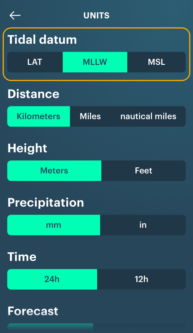
By default, in Windy.app the MLLW is for those with imperial units (feet and inches) and LAT for all others. You can switch it in the settings.
Are there any other datums?
Yes, they are quite a few of them. But these are minor datums that are not as widely distributed as the above two and the MSL. Here is a list of them for your reference:
- HAT (Highest Astronomical Tide)
- MHHW (Mean Higher High Water)
- MHW (Mean High Water)
- DTL (Diurnal Tide Level)
- MTL (Mean Tide Level)
- MLW (Mean Low Water)
- GT (Great Diurnal Range)
- MN (Mean Range of Tide)
- DHQ (Mean Diurnal High Water Inequality)
- DLQ (Mean Diurnal Low Water Inequality)
- HWI (Greenwich High Water Interval)
- LWI (Greenwich Low Water Interval)
- Max Tide (Highest Observed Tide)
- Min Tide (Lowest Observed Tide)
According to NOAA, there are also Station Datum — "a fixed base elevation at a tide station to which all water level measurements are referred", and National Tidal Datum Epoch — "the specific 19-year period adopted by the National Ocean Service as the official time segment over which tide observations are taken and reduced to obtain mean values (e.g., mean lower low water, etc.) for tidal datums."
How to choose datums and check tides in the app?
1. Click the main menu.
2. Go to "Settings", then go to "Units".
3. Scroll the screen until "Tidal datum"
4. Choose the one you need.

5. Check tides.

Important: the feature is available from version 8.7 for iOS and 8.2.0 for Android. Update your app to see new tides.
Text: Ivan Kuznetsov
Cover photo: Joshbrown / Unsplash
You will also find useful
Latest News
Professional Weather App
Get a detailed online 10 day weather forecast, live worldwide wind map and local weather reports from the most accurate weather models.
Compare spot conditions, ask locals in the app chat, discover meteo lessons, and share your experience in our Windy.app Community.
Be sure with Windy.app.


