How to read surf forecast like a pro surfer
Choose where to surf by yourself!

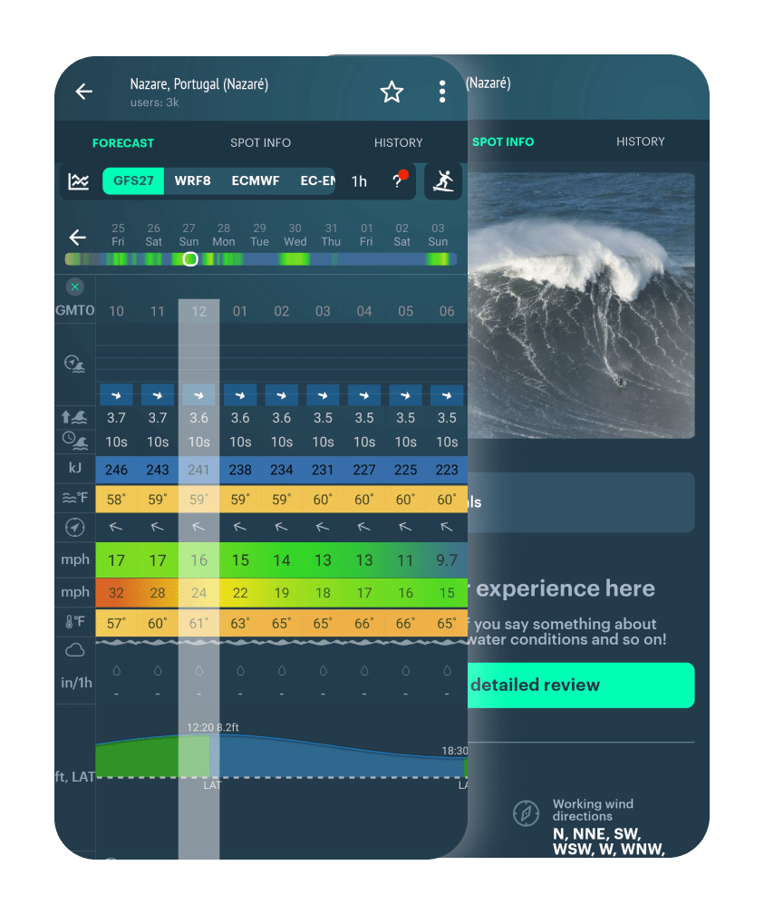

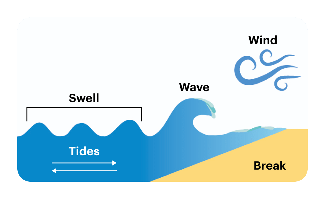
The break doesn't change, it just depends on the spot, but other parameters can be forecasted or calculated.

When all factors are present, a so-called groundswell forms. That's a row of waves with a certain height and period, which appears after storm in the ocean. It often brings clean, well formed surf.

Wind forecast map
When there’s no swell, so called windswell is formed. It’s typical for bays and gulfs.
It's created by less powerful wind and storms that occur closer to the shore. In this case, waves don’t have enough distance to form clean patterns, so the surf is often broken up.
For educational purposes, let’s learn to read a surf forecast for a spot that has swell, tides and wind.


Wind forecast map
1. Swell direction shows you where the swell is coming FROM
2. Some spots are very sensitive to swell direction, for example:
3. The majority of spots are not that sensitive to small variations, and many generally work in all directions of the swell.
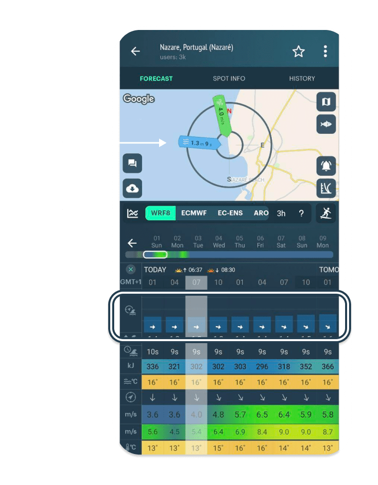
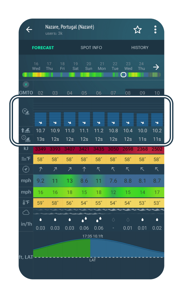
Let’s say, the swell direction is good for this spot.
It's time to determine wave size.
It’s based on:
The general rule is: The higher the swell, the more powerful the waves will be. Wave period (the time of the complete wave cycle) will determine the size of the waves.

To roughly estimate actual wave height, use this rule:
| Swell period | Wave height |
|---|---|
| < 11 s | wave height < swell height |
| 11-12 s | wave height = swell height |
| 14-19 s | wave height > swell height |
| > 20s | wave height = 2 x swell height |
Example:
If the swell is 1.7 meters high, and the period is 12 seconds, the wave will probably be approximately 1.7 meters or a little more.

Best wind = no wind! (glassy conditions)
If there’s wind, look at speed and direction
| Wind direction | Influence on waves |
|---|---|
| Offshore | good wall of the wave |
| Onshore | more quickly closing out |
| Crossshore | possible current |

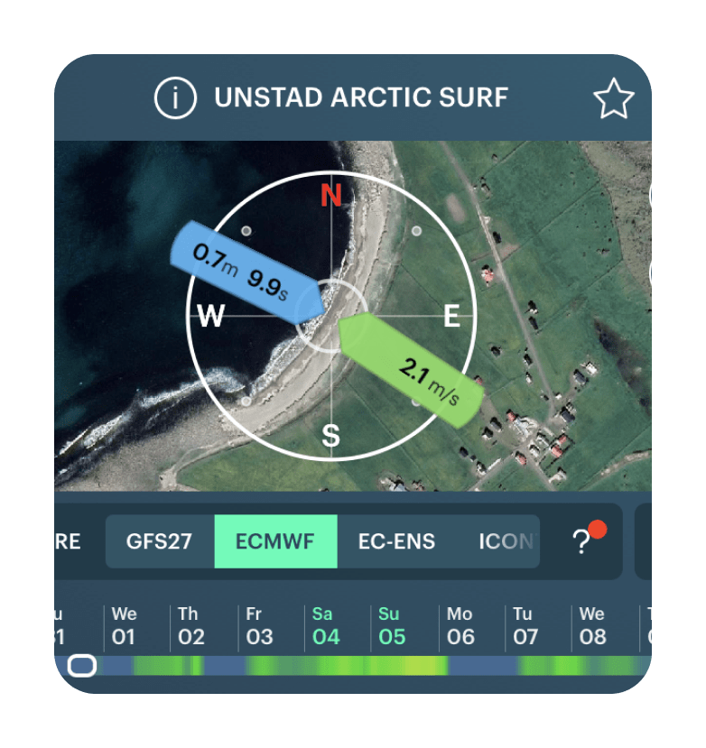
Wind is coming from the land, pushing against the face of the wave, creating neat and tidy conditions. The offshore wind helps waves get a clear shape. It’s similar to “no wind” conditions.
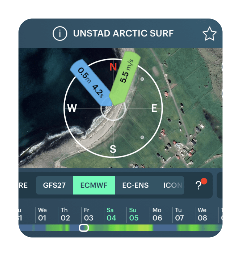
Wind is coming from the sides of the break. Depending on the strength of the wind and the type of break, the wave can be still surfable, however it’s shape tends to get messed up. It can create or affect the current.

Wind is coming from the ocean. It is the worst type of wind, since the wind is pushing the wave from the back and messing it up. If the wind is light, the wave can still be surfable.
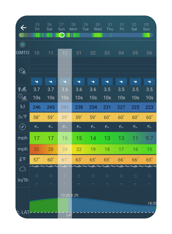

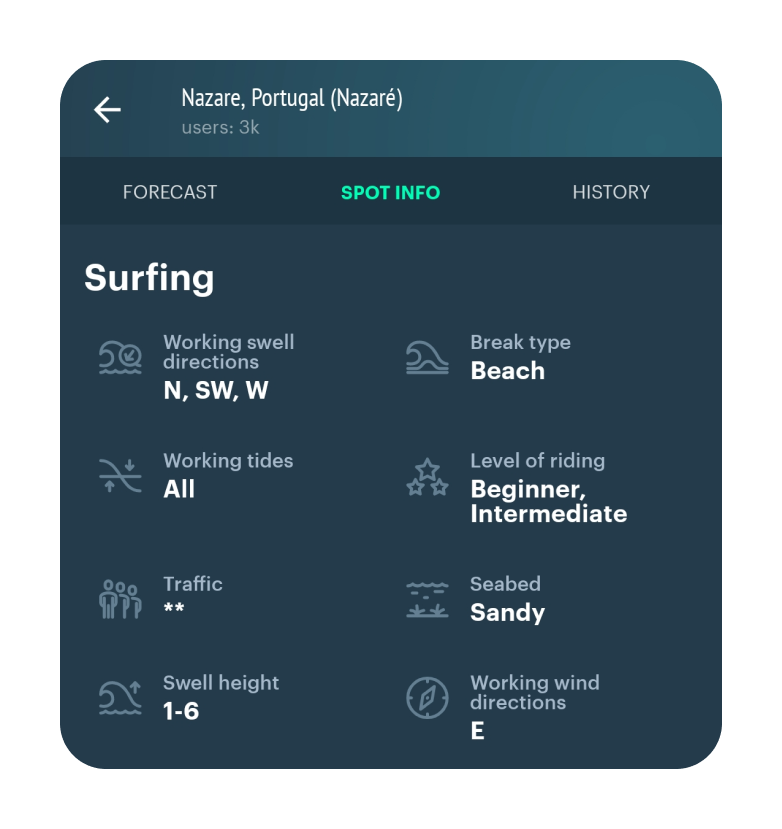
Check out the SPOT INFO section or other resources to learn about a certain spot.


On point breaks:
The waves rise due to the part of the land that protrudes into the ocean. It can be an island, a small peninsula, a cape, a ridge of stones.
On reef break:
Waves rise up colliding with the reef or coral shelf. Due to the fact that the reef remains unchanged, waves like that have more constant shape and size.
On beach break:
Wave are formed due to the alluvium of the sandy bottom which generate “sand banks”. Unfortunately, beach breaks have much more instability and mobility than point and reef waves, as the shape, length and peak of the wave is constantly changing.


Sometimes you can also check the type of break using the sattelite map view.

Thousands of surf spots have reviews from other surfers in Windy.app.

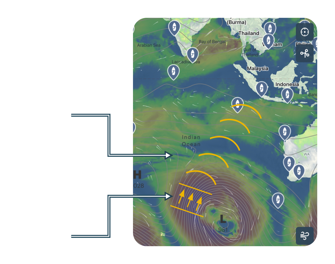
The strongest storms are associated with cyclones (low pressure areas, the center is marked by the letter “L” ). Winds blow along isobars (lines around the letter “L”). The closer the isobars are to each other, the stronger the winds.
These storms produce swell.
If you know where the cyclone is, you can predict where the swell will be in advance.

T+00h

T+12h
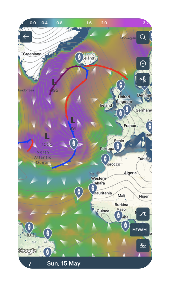
T+24h

T+36h
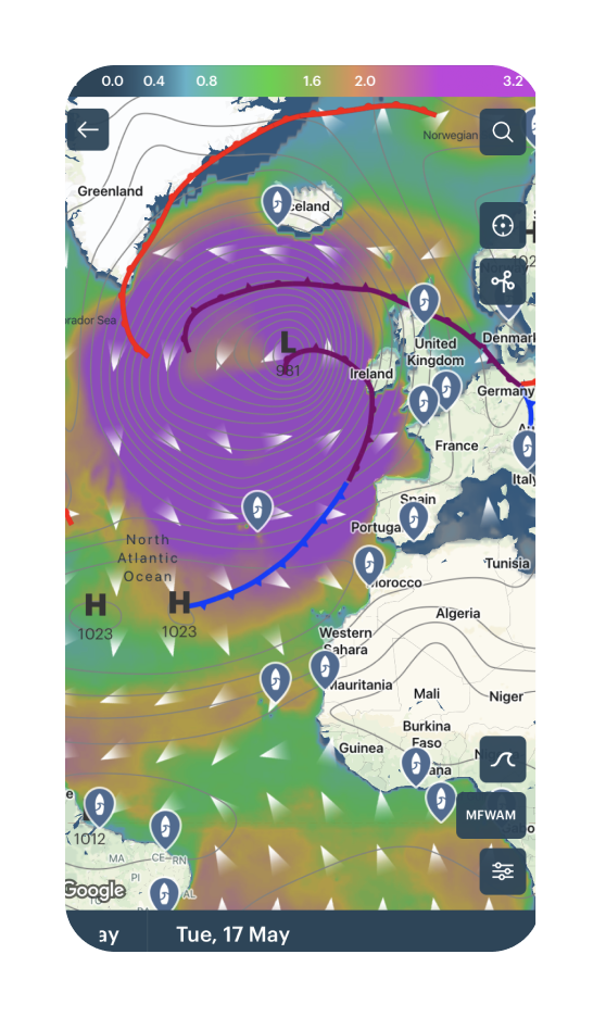

-> Go surfing :)
Now you know how to check the surf forecast by yourself. Good luck!
