
How does fog form
Сlouds that form near ground level, covering buildings, trees and people, are commonly known as fog. In this new lesson of the Windy.app Meteorological Textbook (WMT) and newsletter for better weather forecasting you will learn more about how does fog form
Fog is made up of small water droplets which are so light that they don’t fall to the ground but remain suspended in the air. Dense fog significantly reduces visibility, and can be a major nuisance to drivers and aviators. Depending on its severity, fog conditions pose a real danger to all those who have been affected.
The word fog usually refers to conditions when visibility is less that 1km, whereas similar conditions, but with visibility between 1 and 10 km are called a mist or haze.
How the fog forms?
Air always contains some water vapour which varies from a small amount in the desert to a massive amount over lakes and seas. However, there is ratio of the actual water which is conveniently expressed as a percentage and called the relative humidity of the air. The relative humidity of 100%, for example, means that the air contains the maximum possible amount of water vapour, while the humidity of 50% means that the air now contains only a half of it.
Another important factor is the air temperature. The higher the air temperature, the more water vapour it can contain. So, by definition, warm air contains more water vapour than cold air. It turns out that if the air starts to cool down, its relative humidity begins to grow, even though the amount of water vapour in it hasn’t changed. If the relative humidity rises up to 100%, we will be talking about saturated air with the maximum possible amount of water vapour the air can hold. In case the air temperature goes down, excessive water vapour will appear and turn from gas state into liquid — small droplets of water hanging in the air.
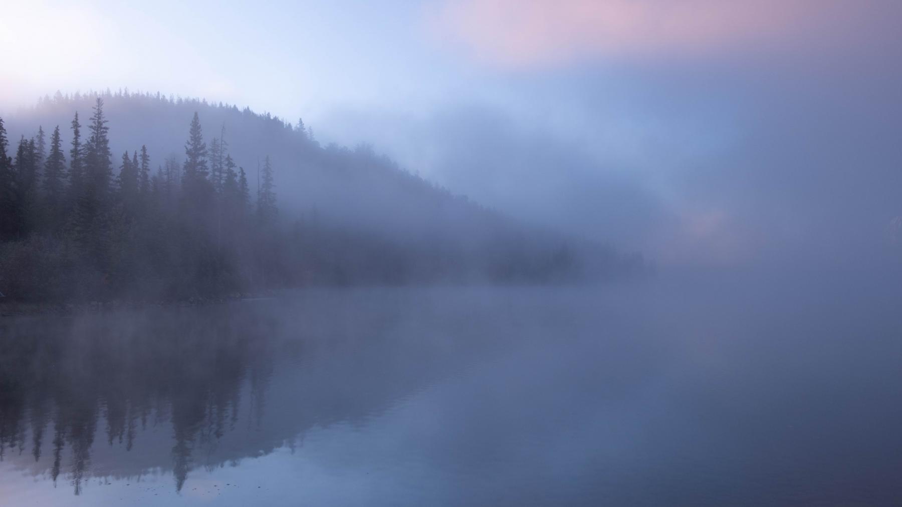
Fog forms on the river. Photo: Anna Goncharova / Unsphash
This process is known as fog formation. If you cool the air right near the ground, its humidity will exceed 100%, and those tiny droplets looking like a white veil of fog will form.
Why does the air temperature go down?
There are several reasons for cooling of the air which leads to the formation of fog. We are going to look at the two main ones: advection and radiation.
Advection refers to movement. If warmer air moves towards colder areas, it cools down upon contact with a cold underlying surface, and fog can form. Such fogs are a common sight over the oceans in summer. The oceans in summer are usually colder than land, and if the wind blows from the mainland into the sea, then it just brings warm air to the colder surface. In winter, advection fogs are more common over land.
Radiation fog forms on calm, clear nights. After sunset, the land cools down relatively quickly. The air temperature in the surface layer is also going down. If the night is cloudy, some of the heat will be reflected by the clouds; they can prevent the planet from cooling down too much overnight. But if the sky is clear, the temperature near the ground can drop so much that fog will form. Most often, this type of fog can be found after sunset in the fields and sheltered valleys. It is quite patchy and usually goes away the following morning under the sun’s rays.
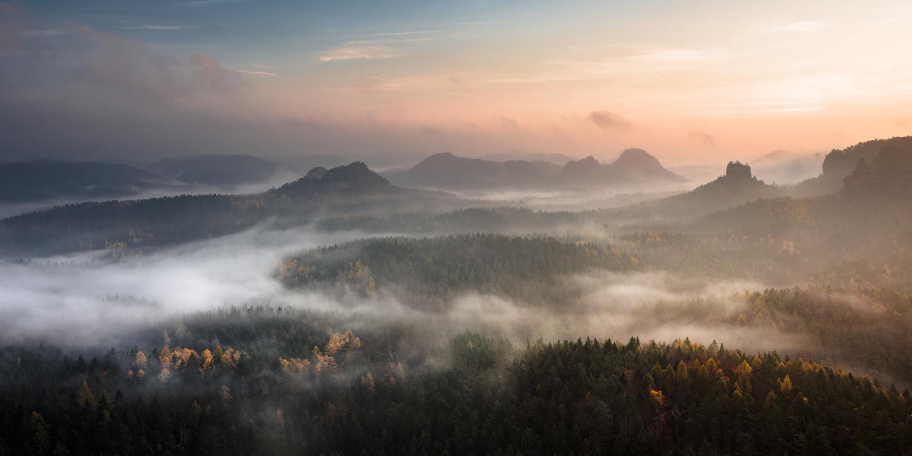
Fog from a bird's-eye view. Photo: Artem Sapegin / Unsphash
Evaporation fog is also an interesting phenomenon. Its formation isn’t connected with the air cooling. If a surface is very hot, the water actively evaporates from it. When the air is cold (or it is already saturated), some of the evaporating water will immediately condense, turning into water droplets. Just think of a boiling kettle: the “steam” coming from the kettle is actually fog.
The steam condenses directly above the source of moisture, while a short distance away, where the air is drier, it evaporates again. We see this when our kettle boils; the same happens with the fogs, the length of which may not exceed several meters in height. Evaporation fog is common in cold weather over warm water bodies, or on a cool evening after a warm summer rain.
Although fogs can be classified by type, they look very similar. Typically, there is more than one reason why fogs are formed. No two fogs are controlled by exactly the same combination of factors, which makes forecasting the formation of fog extremely difficult.
Where to find and how to forecast fog in the Windy.app?
Forecasting fog has been made easy with an Aerological Diagram, which is available in Windy.app for Android in the menu of spot:
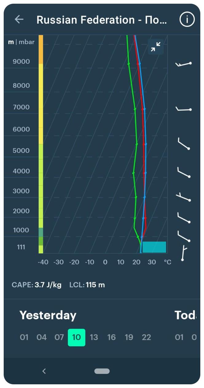
Fog forecast with an Aerological Diagram in the Windy.app for Android
The stratification curve (red) and the dew point curve (green) should come out of the same point and completely overlap up to several dozens of meters. This means that the humidity in the surface layer is close to 100%, and there is a high chance of fog.
Another important condition is a stable stratification of the atmosphere in the air above the fog (the condition curve (blue) should be to the left of the stratification curve). It is not necessary for the entire atmosphere as even a thin layer directly over the fog is sufficient. If the stratification is unstable, then the air nearest to the ground will begin to rise, and the fog will quickly go away.
Text: Windy.app team
Cover photo: Eberhard Grossgasteiger / Pexels
You will also find useful
Latest News
Professional Weather App
Get a detailed online 10 day weather forecast, live worldwide wind map and local weather reports from the most accurate weather models.
Compare spot conditions, ask locals in the app chat, discover meteo lessons, and share your experience in our Windy.app Community.
Be sure with Windy.app.


