
Nautical charts — an essential navigational tool for sailors and marine fishermen
Nautical charts are an indispensable navigational tool at the disposal of every yachtsman and marine fisherman. It is the starting point of any sea voyage and your best friend all the way back to marina or port. In this article, we explain what nautical charts are, how to read it, and where to get them online.
What are nautical charts?
Nautical chart is a type of geographical map created for the purposes of better marine navigation in various types of activities: ocean freight, sailing, recreational boating, yachting competitions, as well as offshore fishing. Such charts are made on the basis of hydrographic surveys, which are quite complicated and time-consuming.
In general, nautical charts look like regular maps with the one major difference — they show the features of the coastline, water depth in the port area and in the open sea, and the general relief of the seabed. These are three main indicators of the charts, which are vitally important to know for anyone who goes to sea on a sailing vessel.
With the help of such charts, it is possible safely and comfortably to go to sea, anchor, avoid running aground, keep the hull of the boat intact, get around underwater rocks, and more. But not only that. In addition to coastline features, water depth, and sea relief, nautical charts also provide a lot of other useful information such as:
- Depths and characteristics of the bottom ground
- Natural and artificial navigational objects, including these, which can be dangerous to navigation (rocks, stones, shipwrecks)
- Navigation aids and landmarks
- Sea channels and recommended routes, anchorage sites, marks of separation of ships traffic, sightlines, and submarine cables
- Tides information: LAT, MLLW, MSL
- Data on coastal areas (rivers, road network, state borders, etc.)
All this is also extremely necessary for any yachtsman to have an even better understanding of conditions of navigation, possible obstacles, and so on.
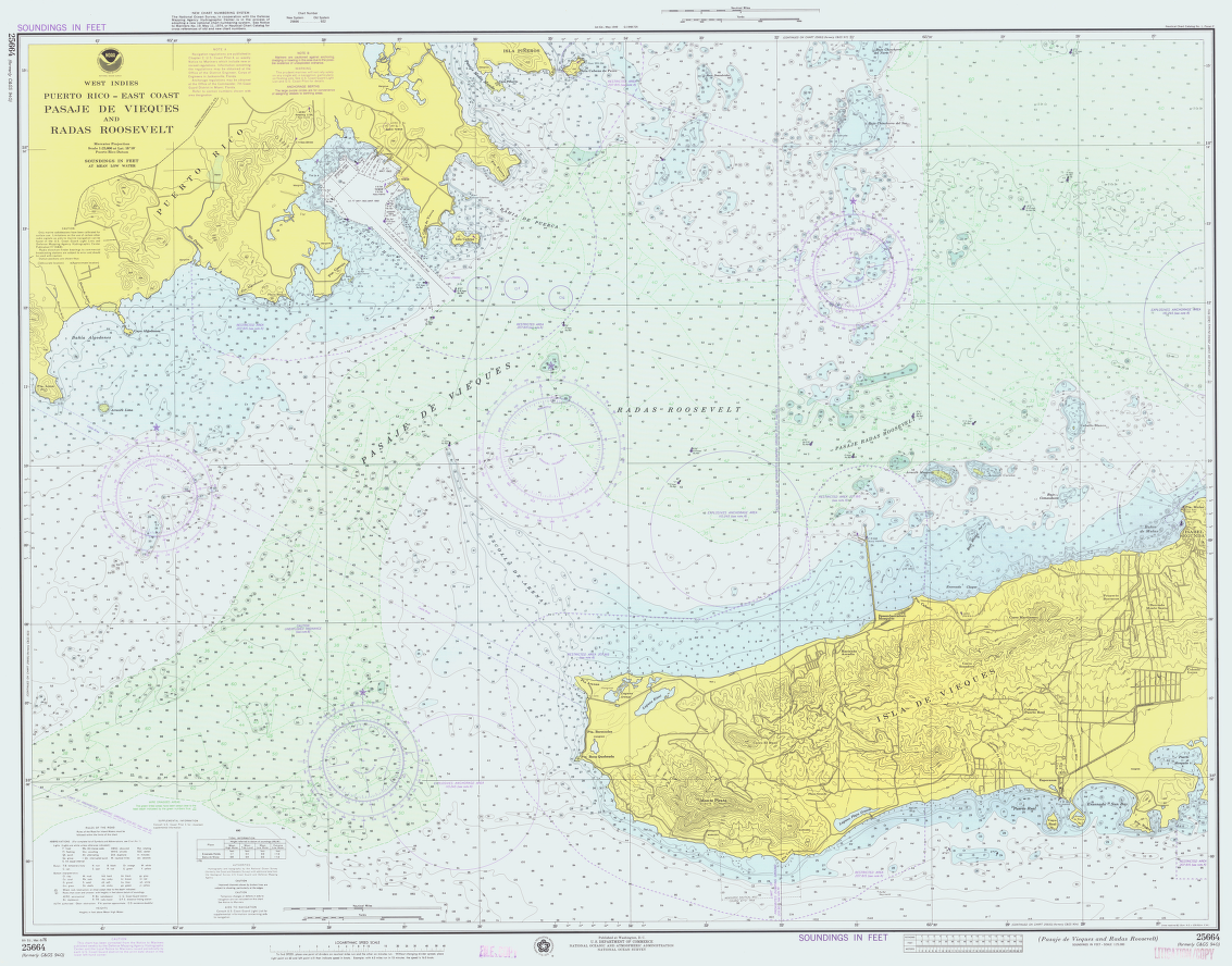
A 1976 United States NOAA chart of part of Puerto Rico / Wikipedia
The main types of nautical charts
Nautical charts come in several types depending on scale and purpose, format, source, and other parameters.
Scale and purpose (4 types of nautical charts)
- General charts (scale 1:5,000,000 — 1:1,000,000) are needed for the general study of sea navigation conditions in open sea far from the shore.
- Route charts (scale 1:1,000,000 to 1:100,000) are used for navigation between ports also at a distances from the shore.
- Local charts (scale 1:100,000 to 1:25,000) are designed to support navigation close to shore and/or in narrow straits and skerries.
- Nautical plans (scale 1:25,000 to 1:500) are intended to help sailor to make successful entries to ports, bays, anchorages, etc.
Source
Official charts are charts produced by national hydrographic offices. For example, in the US these are NOAA nautical charts of the National Oceanic and Atmospheric Administration. NOAA nautical charts are the most popular and widespread, especially for coastal and marine areas of the United States, North America, and the Caribbean. Another example is the Admiralty Charts of the United Kingdom Hydrographic Office (UKHO).
Unofficial charts are issued by different private editorial companies. Such charts can be also used as they may contain additional information of particular interest to certain groups of sailors or fishermen.
Area of coverage
UKHO and other organizations make charts not only for the countries of their origion and surrounding areas but also for other parts of the world. That is, you can find UKHO maps for the Adriatic coast in Italy, North Africa, and so on.
Format
Paper charts are produced in a forms of individual charts, a collections of charts for specific regions of the world, and as books and atlases. For example, in the United Kingdom, there is British Admiralty Collection of charts. Sometime they are called also "old nautical charts" due to the transition to their electronic versions.
Another example of such a books is the Atlas of the Oceans, consisting of several books published between 1970 and 2000 in Russia. Here's what Alexander Ovcharenko, a UX designer and yachtsman who received the Atlas as a New Year's gift from his wife for 2019–20, writes about it:
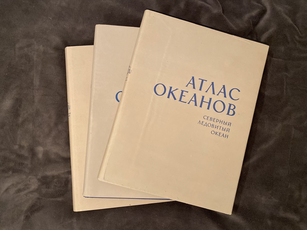
Atlas of the Oceans. Alexander Ovcharenko

Atlas of the Oceans. Alexander Ovcharenko
Atlas of the Oceans. Alexander Ovcharenko
"The atlases are dedicated to all four oceans — the Pacific, Atlantic, and Indian Oceans, and the Arctic Ocean.
Each volume is several kilograms, with sides 36 by 47 centimeters and about 4 centimeters thick.
The volumes describe the geography, the history of discovery, the ocean floor, climate, hydrochemistry, flora, and fauna, as well as some reference information for navigation: general port plans, information about sunrise and sunset, and so on.
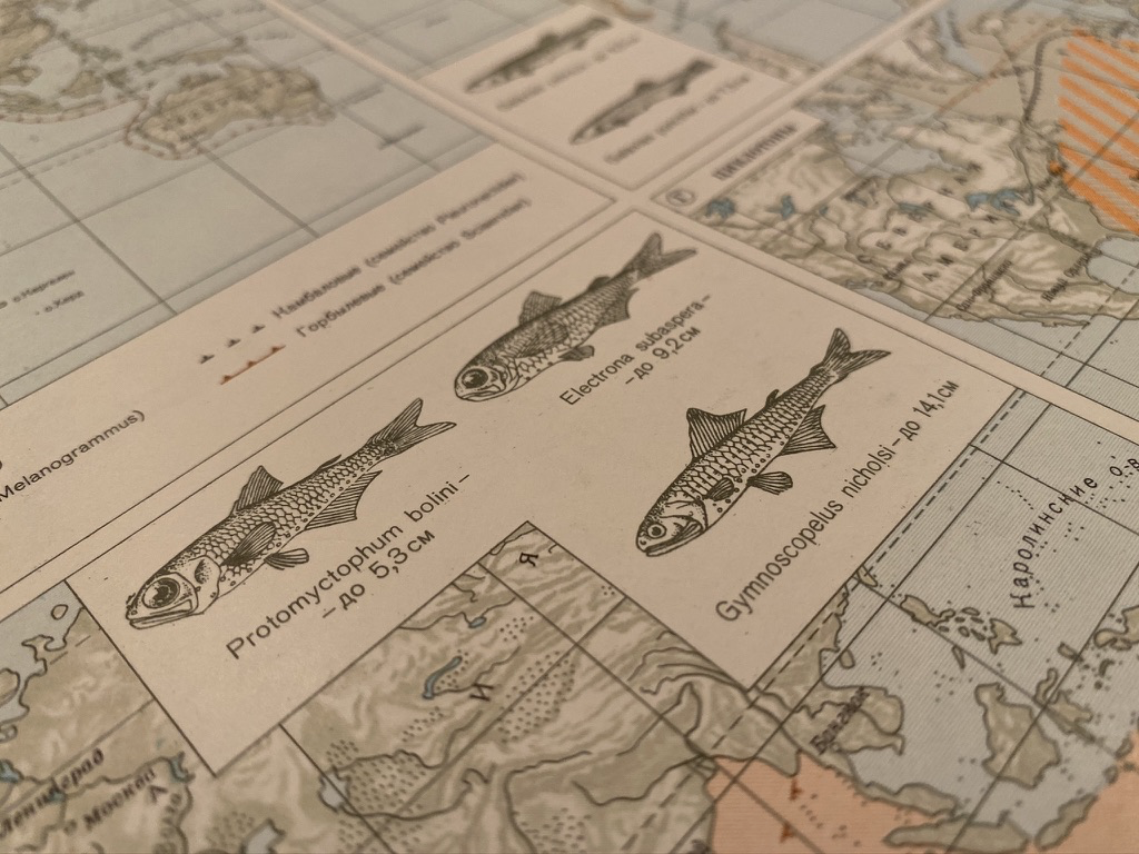
Basically, the atlas contains cartography with various information plotted on top (what we call overlays at work). But it also has charts and illustrations.
It is also impossible not to appreciate the design of the Atlas and the attention to detail as very high level, within the tradition and technology that existed at the time. It's amazing that all of this was done in the pre-digital era. In fact, they reflect the handwork of dozens of institutions and hundreds of people."
Electronic navigational charts (ENC) come in several additional types:
- Digitized paper charts in JPG, PDF, and other formats. These charts can be viewed online or downloaded to your computer, tablet, or phone so that you always have them with you. Paper nautical cards are usually very large in size and are not convenient to use in a small room or to store.
- Online nautical charts can be digitized images of paper charts as well as interactive maps, embedded in the site itself, which can be used as a navigational tool: to study the designations, pave the route, obtain information with the contacts of marinas, and contact them directly from the site, and so on and so forth.
- Electronic navigational charts (ENC) and the Electronic Chart Display and Information System (ECDIS) come in two main categories: vector and raster. Such a computer system integrates charts with global positioning system GPS data, radar data, automatic identification systems of ships, and other things. A special device called "chartplotter" is used to view these charts.
- Mobile nautical charts are the same digital versions of paper nautical charts that can also be found in special mobile applications for yachting and various types of boating. They are useful because you can open a chart directly in the app when studying the situation at sea in the complex determining the weather and plotting the route simultaneously.

Electronic Chart Display and Information System (ECDIS) / UKHO
Which nautical charts are better: paper or electronic?
There is a debate about that.
On the one hand, the world is moving into the digital age, where everything is converted into an electronic format. Using electronic charts is like having an entire music collection on your smartphone instead of a couple of CDs. It is convenient. The main advantages of electronic nautical charts over paper charts are reduced workload, easy correction, navigation in real-time, accuracy, easy route monitoring, prediction of special maneuvers, availability of charts, access to additional information resources, and many others.
On the other hand, electronic nautical charts are not always easy to use — they are, in principle, more complicated than paper charts. Navigation on paper charts is a skill that you need to master more or less once in your lifetime. This does not happen so easy with ECDIS. The disadvantages of electronic charts are over-reliance, too much information, complacency, wrong settings, alarm fatigue, and others.
Most likely, the solution is the same as in other areas — to use both paper and electronic charts, taking advantage of both formats and leveling their drawbacks.
Yet, keep in mind that "NOAA has started to cancel some individual paper charts and will shut down all production and maintenance of traditional paper nautical charts and the associated raster chart products and services by January 2025. Mariners and other users of nautical charts are encouraged to use the electronic navigational chart (NOAA ENC), NOAA's premier nautical chart product."

Part of nautical chart of the NOAA's Office of Coast Survey of the National Ocean Service / NOAA
Price
- Free nautical charts are available without charge from various sources, including NOAA and UKHO. In general, these are basic charts in a limited quantity. For example, you are likely to find nautical chart of the Hudson Strait in New York City in the open-access of the past decade or even century, but you will not find its newer version or another less popular location.
- Paid nautical charts are usually expanded versions of the standard free nautical charts, their newer versions, or extra services that offer various sources in addition to the purchase of the charts.
How to read nautical charts?
In general, reading nautical charts is simple. They are presented in the Mercator projection. That's how we represent the round earth on a flat map. You have already seen it countless times looking at any paper or electronic 2D map. It allows a ship’s course to be plotted in a straight line.
Like any geographic map, nautical charts have a scale, geodetic and elevation bases, internal frames and their breakdowns, a cartographic grid, and other elements.
Then it all depends on the type of chart. Therefore, every nautical chart should be studied in advance, before you go to sea, to learn how to read the specific signs and markings on it.
Normally, the national hydrographic agencies such as NOAA and UKHO publish what is known as “Chart #1”, which explains all the symbols, terms, and abbreviations used on charts, taking as a basis the universal designations accepted all over the world. So reading nautical charts symbols, in particular, is easy. Some signs are simply intuitive — anchor, marina, and the like. That is, once you learn them, you do not have to do it again and again. The more different charts you use, the easier and faster you can read them.
But each agency has the right to add its own elements to the chart. As NOAA specialists say, "nautical charts are an art and a science at the same time". Usually they are also contain an exact list of designations in one of the corners of the map or on the backside.
Note that the numbers on the chart are in the units of measurement of the region in which they are used: there can be some differences between the U.S. and the rest of the world. If you are traveling long distances this can be critical. For example, on this "new style" Admiralty nautical chart below of the approach to Riga, published in 1970, the depth is written in meters and tenths of meters for depths less than 20 meters.
.jpg)
1970 Admiralty chart of the approach to Riga / G.S. Ritchie (UKHO)
Where to get free nautical charts online?
Nautical charts can be found on the official NOAA and UKHO sites. For example, "over 3,500 Standard Nautical Charts (SNCs) and 14,000 Electronic Navigational Charts (ENCs) are available with the UK Admiralty portfolio offering the widest official coverage of international shipping routes and ports, in varying detail." There are other sources of such charts like Openseamap.org, and on websites and mobile apps for yachting and outdoor activities. Sites and apps, as a rule, do not create their own maps, but use databases of other services, but provide them in a more convenient form.
For example, in the Windy.app for Android mobile OS you can find NOAA nautical charts free by activating a special layer with the same name on the Weather map. The data on the map is for the U.S., including the East and West Coast, the Gulf of Mexico, and the Great Lakes.
Nautical charts app like Windy.app helps you also to get the weather forecast. In addition to the charts, a special Sail weather profile is available in the app with a ready set of weather parameters, as well as a Fish Pro weather profile, which is suitable for those who go to sea to gather a big catch.
On the same Weather map you can find thousands of marinas and ports around the world with useful information and contacts. More, in the iOS version of the Windy.app you can contact them directly from the Weather map by phone. You can go to each individual marina page to find additional contact information.
Read more in the Mini guide to sailing and yachting with Windy.app.

NOAA nautical charts for the United States in the Windy.app for iOS

NOAA nautical charts for the United States in the Windy.app for iOS
Text: Ivan Kuznetsov, an outdoor journalist, editor and writer from the Dolomites, Italy, and Karelia, Finland, with 10 years of professional experience. His favorite sports are hiking, cycling and sauna. Read his other articles
Cover photo: Mateusz Zatorski / Unsplash
You will also find useful
The beginner's guide to types and purposes of yachting boats
How to get first-time skipper experience
How to use the weather forecast for yachting
Latest News
Professional Weather App
Get a detailed online 10 day weather forecast, live worldwide wind map and local weather reports from the most accurate weather models.
Compare spot conditions, ask locals in the app chat, discover meteo lessons, and share your experience in our Windy.app Community.
Be sure with Windy.app.


