
Expert tips on weather forecasting for yachting
Imagine you have a week of sailing, a one day sailing race, or you need to move a yacht between two marinas, anything... What can you do a week in advance to be better prepared for possible weather changes? What about three days or the day before your trip? Below you will find a few of my tips as a meteorologist on how to properly use the weather forecast for yachting in each of these three situations using Windy.app as an example.

Ilya Drigo, professional meteorologist, developer, and researcher
7–10 days before going to sea
Check global weather models. They calculate the weather forecast for a week and 10 days ahead. The main global models are ECMWF (European Centre for Medium-Range Weather Forecasts with headquarters in Reading, UK), GFS27 (Global Forecast System of the US National Weather Service), and ICON13 (Icosahedral Nonhydrostatic by the German National Meteorological Service). The forecast of the latter is shorter — 5 days, but it has the spatial resolution of 13 km (8 mi) against 27 km (16.7 mi) for GFS.
Activate the Ensemble weather model. It is a variant of the ECMWF model in the case of Windy.app. It will help you understand how unstable the weather situation is in your region or the area you are going to. An Ensemble model is also indispensable if you need the most accurate forecast more than three days in advance. This feature allows you to be sure in a forecast, but will also help you to recognize in advance the low accuracy of a forecast due to a difficult weather situation.
Learn the weather history or reanalysis. That's how you see how this particular marina or this bay is doing around the time you are going there. The history of the weather is statistical data on the state of the atmosphere and the ocean, collected on the basis of regular meteorological observations made from hour to hour, day to day, month to month, year to year — continuously. It is weather on average.
Three days before moving the yacht between marinas
Look at both global and local weather models. The vast majority of local models give a forecast for at least three days and, accordingly, their readings can be trusted. There are much more local models than the global ones. The main regional models, as they are also called, in the Windy.app are ICON7 and WRF8 for Europe, NAM and HRRR for North America, WRF Japan for Japan and North Korea, and several others. You have almost the entire world divided into regions at your disposal.
Compare weather forecasts using the Compare Mode. You need to compare forecasts from different sources in order to read them correctly to get more accurate data for the spot (marina) or route you are interested in. For example, even a slight difference in the forecasted wind speed can affect the choice of sailing equipment. And if an Ensemble model is, let’s say, a large-scale thing, then by comparing many different models — especially local ones — with each other, we can figure out the particular weather situation.
Study the upcoming weather fronts. Three days in advance, they are fairly well predicted with updates every 12 hours. In those three days, you can learn what your weather situation will be, whether a cold front or a warm front is going through your marina or sailing route. Remember that a cold front brings colder air and good visibility. With a warm front, the sky is usually completely overcast — at a distance of more than 2,400 km (1,491 mi). Warm weather fronts also pass with rains, sometimes with thunderstorms.

How to use the weather forecast for yachting. Velerya Milovanova / Windy.app
On the day of the regatta
Again, look at all available weather models. The algorithm on race day is the same — we estimate how much they diverge from each other. But this time pay more attention to the model the forecast of which seems most accurate to you. For example, if you are in the Mediterranean Sea, there are three weather models for this region: OpenWRF, Open Skiron, and AROME. The latter has the highest resolution of 1.25 km (0.7 mi) and the shortest forecast period of 1.7 days (42 h). So it suggests that it may be the most accurate in your situation.
Open weather radars for your area. Radars are one of the ways to collect weather information (other ways are weather stations, probes, satellites, and so on). Radars tell us about the weather state right now. A forecast that is made by a radar is also called "nowcasting" (yes, simply from the words "now" and "forecasting") — that is, what we can use in a given time frame from a few tens of minutes to a few hours. Let’s say if you’re going to sea in two hours, is there going to be some serious thunderstorm front that’s going to bring rain? If so, it might be worth going now and waiting it out in open water.
Analyze local weather conditions for sailing. Better to do it, of course, the day before with a cup of tea with a local captain, who will definitely tell you that the wind behind this island behaves one way or another. Or, for example, weather models are just learning how to add local winds into the forecasts. So for now you just need to know them and take them into account. Local conditions are a big part of what determines how you will sail. You can find local sailors by using the marina contacts found in Windy.app’s database or in the marina's Chats.
And also...
There is a specialized application from the Windy.app team called WindHub made by meteorologists and yachtsmen for the same yachtsmen. It has a simpler design and only the features that yachtsmen need, it’s quicker to understand than Windy.app...
Here you can also choose different weather models, they are concentrated around the map. For example, right now I choose a point in Gibraltar and I see that the wave is one meter (3.2 ft) with a period of 10 seconds. I can include different things like wind barbs or weather fronts on the map. You will have them displayed on the main screen.
All in all, it’s easy to use. As well as Windy.app, WindHub is also available for both mobile platforms: iOS and Android.
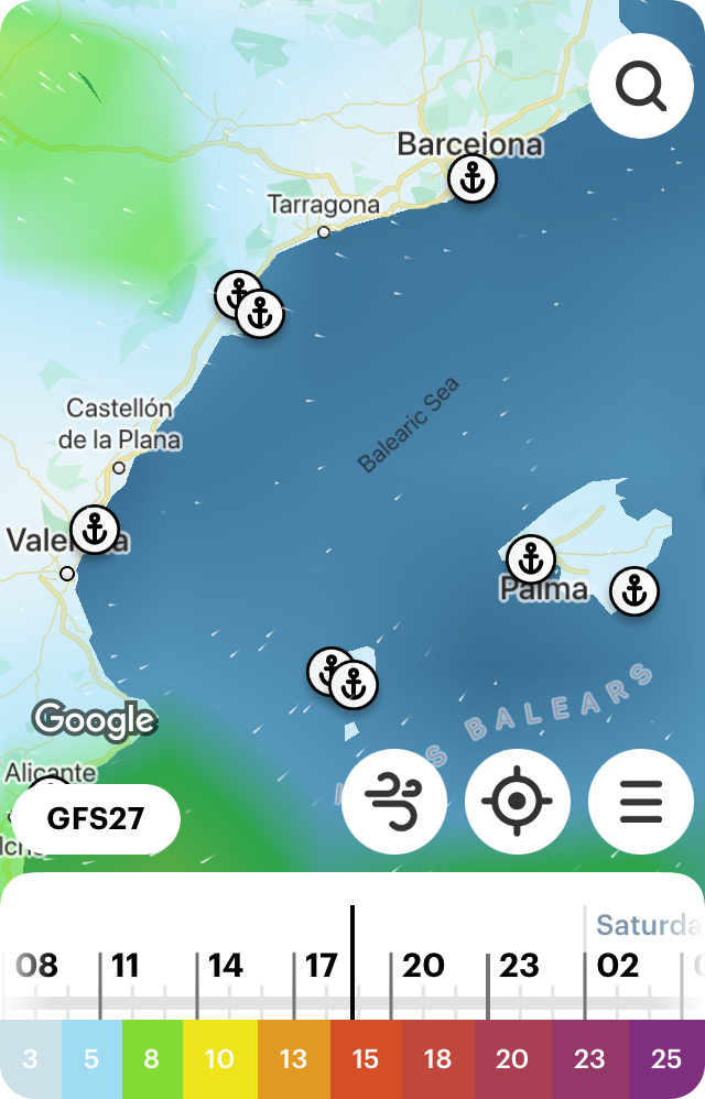
Weather Map of the Balearic Sea in the WindHus for iOS
Text: Ilya Drigo, pro meteorologist, developer, and researcher with a Bachelor’s degree in Oceanography, Meteorology and Hydrology from the Lomonosov Moscow State University (MSU), Windy.app’s ex-chief meteorologist. His favorite sports are hiking and sailing. Ivan Kuznetsov and other Windy.app authors contributed to this article
Cover photo: Renan Brun / Unsplash
You will also find useful
Nautical charts — an essential navigational tool for sailors
Find out if your yacht license is valid in different parts of the world
The beginner's guide to types and purposes of yachting boats
Review of sport centerboard boats and catamarans: types, sizes, history
The fire on board. Learn how to prevent it
Latest News
Professional Weather App
Get a detailed online 10 day weather forecast, live worldwide wind map and local weather reports from the most accurate weather models.
Compare spot conditions, ask locals in the app chat, discover meteo lessons, and share your experience in our Windy.app Community.
Be sure with Windy.app.


