Hurricane Delta 2020 Is Over and No More Dangerous
The hurricane Delta 2020 is a category 3 dangerous hurricane, which is active in the Gulf of Mexico near the southern coast of the US. It is expected to reach US in the next 1-2 days.
Warning: if you live in the area affected by hurricane Delta 2020, follow all precautions recommended by local police, fire department, medical services, and other official government organizations to minimize the impact of typhoon. Contact the appropriate services if you experience difficulties.
Bookmart this page to get hurricane Delta 2020 updates, tracker and live map, forecast, latest news, quick facts, and detailed information from this page.
Update: October 12, 2020, Friday, 12:00 a. m. UTC. Hurricane Delta 2020 Is Over and No More Dangerous
The hurricane Delta 2020 is over and no more dangerous.
Update: October 9, 2020, Friday, 12:00 a. m. UTC. Hurricane Delta 2020 Made Cayman Islands a Perfect for Surfing, But Can Bring Life-threatening Events to the US
Hurricane Delta 2020 is now located in the northwestern part of the Gulf of Mexico in only 210 miles (340 km) from the US coast. It has category 3 in SSHWS which makes it one of the strongest hurricanes to hit the US this season. Wind speed near the center is 105 kt (120 mph or 195 km/h) with gusts up to 130 kt (150 mph or 240 km/h).
After a long period of moving northwest, Delta is expected to turn northeast in several hours. It is expected to make landfall in Louisiana late on Friday, October 9.

According to the forecasts, the Gulf of Mexico US coast from High Island, Texas, to Ocean Springs, Mississippi, is expected to suffer from extreme storm surges. Strong winds can extend east to Morgan City, Louisiana. Flash flooding and even river flooding risk in Louisiana and Mississippi will exist until Sunday.
The biggest cities to be affected by the hurricane are Lafayette, Baton Rouge and New Orleans, Louisiana. In the USA Delta can become the most damaging hurricane of the 2020 season. Everyone in the place of its activity should be especially careful this weekend.
The first land to be affected by Hurricane Delta 2020 several days ago were Cayman Islands. The hurricane center was far from the land so there were no hurricane winds and strong convective events. But the islands were still close to cyclone circulation so high waves were recorded. That made Cayman Islands a perfect surfing place this week.

The hurricane then made landfall in the Yucatan Peninsula (Mexico) as a category 2 hurricane in SSHWS. There were no massive damage or deadly cases either. The Mexican government though had to evacuate thousands of people from the most endangered regions and place them into special shelters.

Cancun, a popular Mexican tourist center, was the most affected territory. Here you can see videos of hurricane related convective events in Mexico.
Update: October 5, 2020, Monday, 12:00 p. m. UTC. Hurricane Delta 2020 in the Caribbean Sea Is Expected to Reach Category 2 in SSHWS and Threatens Southern US States.
Tropical Depression #26 in the Caribbean Sea (Atlantic Ocean) has intensified into Tropical Storm Delta 2020. The wind speed near the center is now 35 kt (65 km/h or 40 mph).
It now influences no land and is located 90 miles (160 km) south of Jamaica.

Satelite image of the hurrcane Sally 2020
The storm is predicted to move northwest. The first territory to be affected are Cayman Islands, especially Grand Cayman with George Town. Tropical Storm Delta 2020 will then move towards Western Cuba. It will strengthen and affect Pinar del Rio and Havana as a severe tropical storm or even category 1 hurricane in SSHWS.
It will then enter the Gulf of Mexico and intensify into a category 2 (or even 3) hurricane in SSHWS.

Projected path of the hurrcane Sally 2020
The landfall will occur on US territory. The primary forecasts expect Louisiana (especially New Orleans) and Mississippi (Gulfport, Biloxi) to be the most endangered territories. Hurricane Delta 2020 is expected to be a destructive event. The next 2-3 days will give more accurate predictions of possible consequences.
Quick Summary Updated Facts About Hurricane Delta 2020
- Name: hurricane Delta 2020.
- Other names: tropical storm Delta 2020, subtropical depression Delta 2020, tropical cyclone Delta 2020, named storm Delta 2020, and others.
- Start date: October 3, 2020.
- Number in the Pacific Typhoon Season 2020: 25th (twenty fifth named storm).
- Type: hurricane.
- Category: 3 in a SSHS (Saffir-Simpson Hurricane Wind Scale).
- Speed: 105 knots (120 km/h or 195 mph) in 1 minute mean.
- Gusts: 130 knots (150 km/h or 240 mph) in 1 minute mean.
- Central pressure: 950 mb.
- Place of activity:
- The Caribbean Sea (Atlantic ocean).
- Cities, regions and countries affected: non.
- Damage: no data.
- Possible end date: October 11, 2020.
- Total possible activity: 7 days.
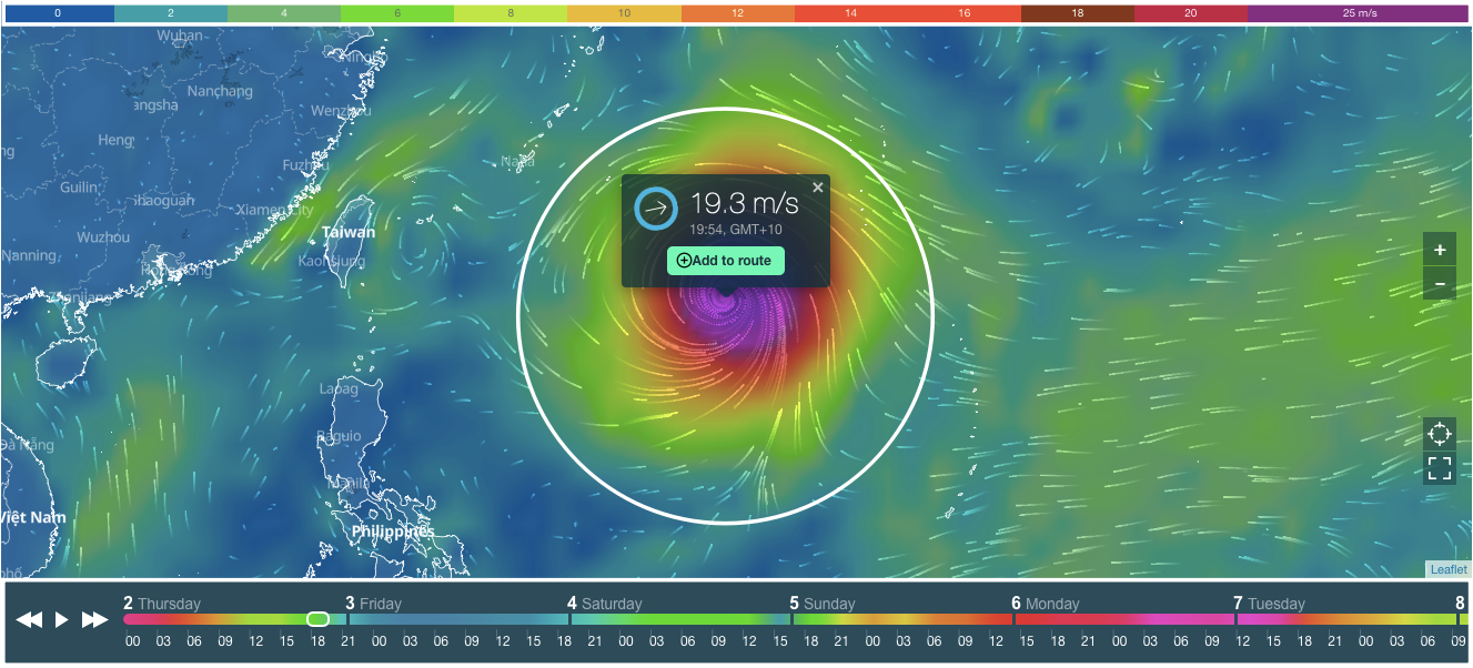
Hurricane Delta 2020 Tracker and Live Map
On the cover of this page, you see tracker and live map of the hurricane Delta 2020.
Scroll or zoom (+ / -) the cover to find out where the hurricane is now, and how strong it is. You can also determine the speed of the hurricane by its color. On top of the live map, there is a colorful scale. The speed is in m/s (meters per second).
At the bottom of the map, there is a weather forecast for the next 10 days. Scroll it to the right to see the projected path (track) of the hurricane Delta 2020. Or push the arrows or the "Play" button to get the forecast.
Weather Forecast for Hurricane Delta 2020
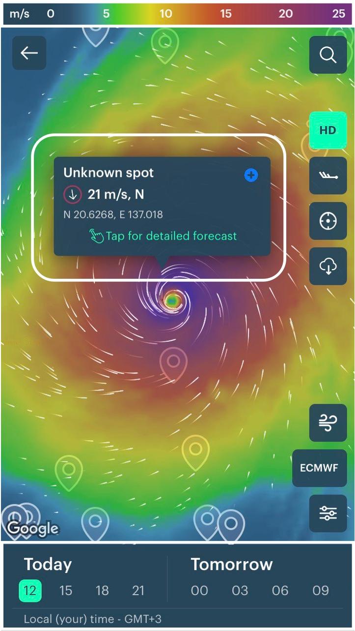
Check the weather forecast in your region in Windy.app for iOS and Android.
In the app you see then same tracker and live map. Do the same to find out where the hurricane is now, and how strong it is. Use many additional app features: 4x larger HD map, Wind Bards, Offline Mode, Wind Gusts, Precipitation, Weathter Models, and different Views of the Map, and other.
All new users living in the area of an active hurricane or typhoon get access to the free Pro version of the app on the time of hurricane or typhoon activity, so they can use professional tools to correctly evaluate weather conditions.
Professional Weather App
Get a detailed online 10 day weather forecast, live worldwide wind map and local weather reports from the most accurate weather models.
Compare spot conditions, ask locals in the app chat, discover meteo lessons, and share your experience in our Windy.app Community.
Be sure with Windy.app.


