
Cirrus uncinus clouds
Cirrus uncinus clouds — the precursors of weather changes. In this new lesson of the Windy.app Meteorological Textbook (WMT) and newsletter for better weather forecasting you will learn more about cirrus uncinus cloud.
Where do cirrus uncinus clouds form?
These clouds are formed very high in the sky — at a height of 7-10 km in moderate latitudes and even higher in the tropics.
The temperature at this altitude is very low, so these clouds do not consist of liquid water droplets, but of solid small ice crystals. At the altitude of their formation, there is already very little water vapor, so the ice crystals that are made of it are very small and rare. Therefore, cirrus uncinus clouds are quite transparent: the sun, moon, and bright stars shine through them.
The precursors of a warm front
Now to the point: what can the occurrence of these clouds in the sky say?
Cirrus uncinus clouds are formed if air rises at a considerable altitude. Where does this flow come from? It’s often caused by a warm atmospheric front. If this is the first time you’ve seen this notion, you can look at our article about fronts. Or we can remind you briefly. A warm front is when warm air moves towards cold air.
Warm and cold fronts
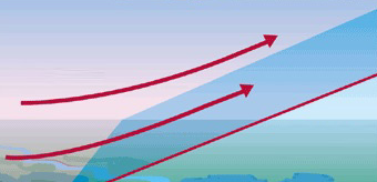
A warm front
The front itself is the border between warm and cold air. Warm air moves towards cold air, it is lighter than cold air, so in the front zone, warm air rises along with the cold air wedge.
Having risen to a height of 7-10 km, warm air is far ahead of the part of the front line, which is near the surface of the Earth (in the picture it is clearly visible).
It turns out that the clouds we observe are 800-900 km ahead the warm front line. The warm front has not yet reached us, but we can already see the clouds connected to it!
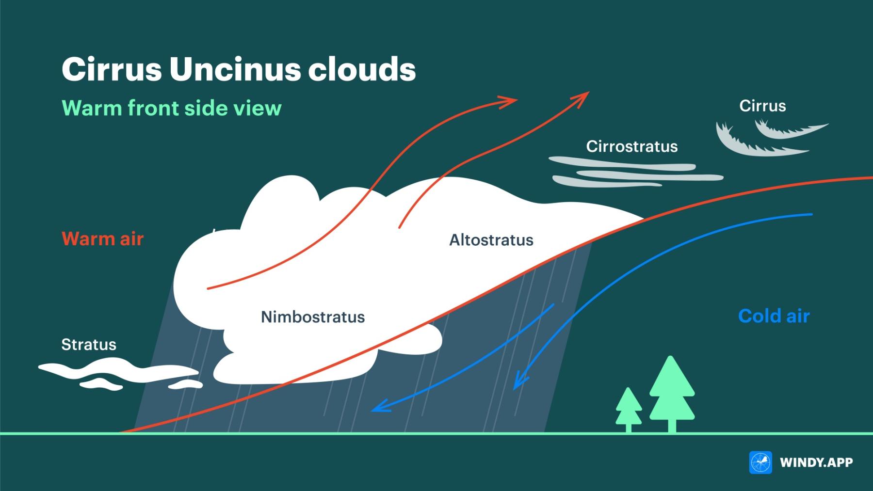
Cirrus unicus clouds. Illustration: Valerya Milovanova / Windy.app
Why are the clouds shaped like this?
The shape is due to the jet stream. There are always big temperature contrasts close to a front that lead to a large pressure difference. And a big pressure gradient means a high wind speed.
Wind always appears where there’s a difference in atmospheric pressure. The bigger the difference, the faster the wind.
The jet stream is a very fast air current at high altitudes. Cirrus uncinus clouds are stretched along the jet stream, so they are long.
The curls are the result of the fact that the jet of fast-moving air is a little loopy all the time. The atmosphere is very unstable and it is difficult to maintain a smooth motion. The jet occasionally ‘drifts’ a little upwards. There, in colder air, water vapour condensation occurs immediately (to be more exact — deposition, as water vapour turns into ice crystals, instead of water drops), and ice crystals are formed of which the curls consist.
Then the jet goes down, but there is no condensation in warmer air, so the clouds seem to break off at the bend, because we see ice crystals, but not water vapor.
Meteorological puzzle
In how many hours one can expect weather changes if there are cirrus uncinus clouds in the sky, provided that a warm front usually moves at a speed of 20-30 km/h? The answer can be verified in practice :)
Text: Windy.app team
Illustration: Valerya Milovanova, an illustrator with a degree from the British Higher School of Art an Design (BHSAD) of Universal University
Cover photo: Unsplash
You will also find useful
Latest News
Professional Weather App
Get a detailed online 10 day weather forecast, live worldwide wind map and local weather reports from the most accurate weather models.
Compare spot conditions, ask locals in the app chat, discover meteo lessons, and share your experience in our Windy.app Community.
Be sure with Windy.app.


