
New British weather supercomputer: what can it do and how will it change our life
It has been recently reported that there will be a revolutionary addition to the weather supercomputer range: the UK Met Office plans to put into operation a new complex valued at $1.56 billion dollars (hardware + 10-year maintenance) in 2022.
For those reading us for the first time: all the current weather forecasts available on WINDY.APP and in general for important tasks are calculated using huge computing power, and some new processors in the process of development are tested on meteorological tasks as the most resource-intensive in principle.
The original report is available here

This will be, firstly, the largest on record addition to the MetOffice (founded in 1854 by the legendary navigator Robert FitzRoy), and secondly, it will make the MetOffice the owner of the most powerful weather supercomputer in the world.
Basically, things are going well in the British Isles as it is. The computing power of the current MetOffice supercomputer, put into operation in December 2016, is estimated at 7 petaflops (27th place in the top 500 most powerful supercomputers in the world). For comparison - the main supercomputer of the Russian hydrometeorological service is several times slower than the modern British one - it produces only 1.3 petaflops.
The new computing complex is expected to be six times more productive than the current one. Besides, its capacity will triple by the end of the 20s.
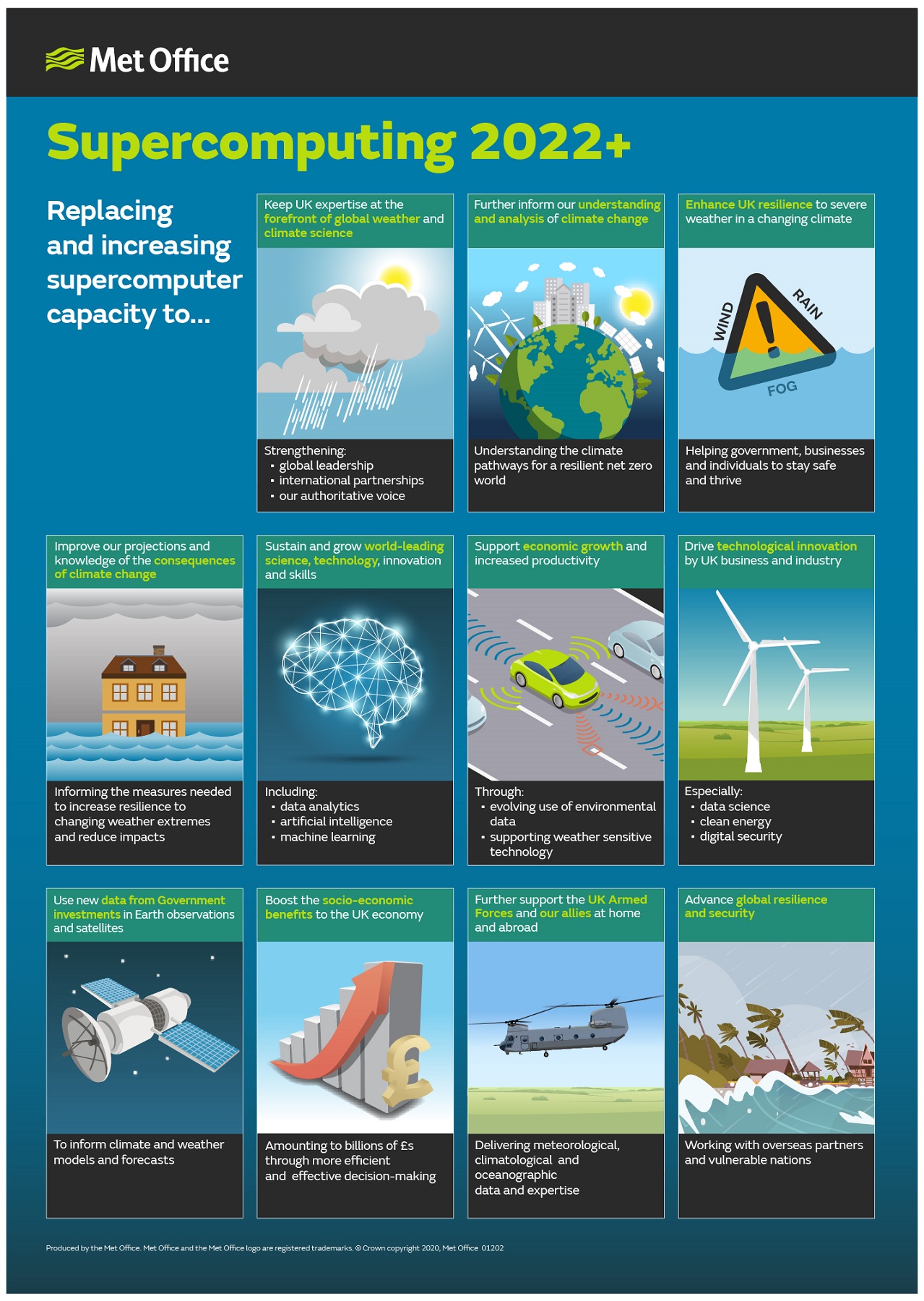
So what can this giant do? Schematically, all the advantages are shown in Fig.2, let's analyze the most prominent ones.
First, of course, the temporal resolution of weather forecasts will improve. If now MetOffice's forecast is made for every hour (previously the "forecast step" was three hours), then with the new computer important updates are expected to be released even more often (now it is done manually by forecasters). This will help to improve the quality of forecast of dangerous weather events, which carry active cyclonic vortices - for example, Cyclone Dennis, etc.
But more important, of course, will be the improvement of the spatial resolution of the forecast (often called "forecast for each street") - we are talking about the wind speed, temperature and precipitation forecast. This, almost for the first time in history, is planned to be achieved with the so-called "seamless atmospheric model" - a new word in predictive meteorology. Today meteorologists around the world use different types of models for different needs. For tracking the movement of cyclones and anticyclones - "global", which model the entire globe. Only large objects can be seen on them. For forecasting breezes, tornadoes, precipitation over lakes and different areas of megacities (London, Moscow, New York) - "regional" - they give a forecast to within kilometers. For the forecast of wind gusts in the streets and at the corners of buildings - "microclimatic and hyperlocal" - they allow you to see the "picture" with an accuracy of up to meters (LES).
The relationships between these types of models can be seen in Figure 1.
So, "seamless" models will combine all the types of models, which will eliminate errors that occur "attaching the models to each other" - as is done now. One seamless model will be able to monitor cyclones and their fronts, as well as wind gusts in an urban environment.
And it seems that the new British supercomputer will be able to overpower the necessary computational speed for the new type of models. For most supercomputers, this remains a dream in online mode.
Latest News
Professional Weather App


