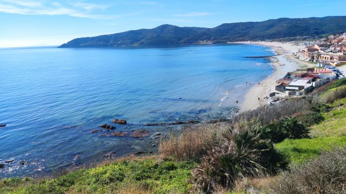
03.05.2026 (Sunday)
- Caution – short wave (5.2 s)
- Moderate wind – experience required (5.6 m/s)
- Dangerous currents (2.1 kts)
04.05.2026 (Monday)
- Caution – short wave (5.8 s)
- Low water temperature – risk of hypothermia (17.3 °C)
- Moderate wind – experience required (7.1 m/s)
- Low air temperature – less comfort (19.0 °C)
- Dangerous currents (2.1 kts)
05.05.2026 (Tuesday)
- Caution – short wave (5.3 s)
- Low water temperature – risk of hypothermia (17.6 °C)
- Moderate wind – experience required (6.9 m/s)
- Low air temperature – less comfort (19.2 °C)
- Dangerous currents (2.1 kts)
06.05.2026 (Wednesday)
- Caution – short wave (4.9 s)
- Moderate wind – experience required (5.1 m/s)
- Low air temperature – less comfort (20.0 °C)
- Strong current – experience required (1.7 kts)
07.05.2026 (Thursday)
- Caution – short wave (4.1 s)
- Low water temperature – risk of hypothermia (18.0 °C)
- Low air temperature – less comfort (19.8 °C)
- Strong current – experience required (1.7 kts)
08.05.2026 (Friday)
- Caution – short wave (4.1 s)
- Low water temperature – risk of hypothermia (17.8 °C)
- Low air temperature – less comfort (18.7 °C)
- Strong current – experience required (1.8 kts)
New Feature!
We just added Weather Alerts. How was your experience?