
The guide to Teide National Park — the most popular one in Spain
Teide National Park is one of the must-see destinations for hiking and biking fans when visiting the Canary Islands.
Its particular weather conditions given by the Teide volcano, its majestic views, and the 190 km² range are the ideal setting for circuits of all levels of demand and experience.
In this article, you will be able to find all the information you need to visit the park: routes for both hiking and cycling, the best time of year to visit it, and all the general information on how to get there and where to lodge.
If you are planning your visit to the Teide National Park, follow all our tips and recommendations.
What is the Teide National Park?
The Teide National Park is located in the center of the Island of Tenerife in the Canary Islands, at an average altitude of 2000m. Inside the park, you'll find the volcano that goes by the same name. With its 3718 m, it is the highest one in Spain. The volcano is the main attraction at Teide.
The Teide National Park is a unique setting, declared a World Heritage Site by UNESCO in 2007 in the category of Natural Sites. At least 80% of the volcanic formations in the world are found in the park. It houses one of the most impressive geological spectacles in the world, made up of a set of caves with special geological characteristics.
It's an active volcano. There is a monitoring and follow-up system by local authorities and a Special Civil Protection Plan for responding to emergencies or risk alarms.
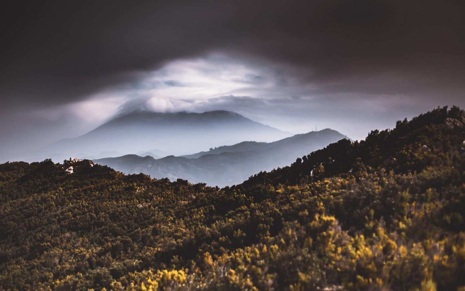
Teide National Park in Spain. Photo: Marek Piwnicki / Pexels
What to do in the Teide National Park?
It is possible to visit the crater of the volcano, but there is a restricted number of visitors each day. It is important to emphasize that this and other accesses to trails require special permits provided by the National Parks office, so it is advisable to prepare well in advance of your visit.
The cable car takes you to one of the highest peaks in the park, as well as offers you the possibility of taking a path of approximately 40 minutes until you reach the highest point of the island.
At the same time, Teide National Park is one of the most acclaimed destinations for hikers and cyclists. Here you will find the most recommended trails for you, with the basic information so that you are able to choose the one that best suits your level.
Hiking routes in the Teide National Park
The park has a network of 30 trails prepared for all levels of expertise:
Basic level: Parador del Teide — Mirador de la Ruleta — el Roque Cinchado — el Burro — Cañadas — Roques de García — La Catedral — Parador del Teide
This is a mostly paved route, with part of a nature trail and a little unpaved path. In addition to passing through several viewpoints, you will also be able to see the most impressive rocky and volcanic formations in the park.
- Distance: 5 km
- Elevation: 2014 m
Intermediate Level: El Portillo Visitor Center — Cañada de los Chupaderos — Risco de las Ventanas
Most of the route is a nature trail, it is a perfect circuit for those who want to find good views and observatories rather than rock formations.
- Distance: 12 km
- Elevation: 270 m
Advanced level: Majua Mountain — Altavista Refuge — Teide Cable Car — Montaña Blanca Summit — Majua Mountain
This route is 50% natural mountain trail and the remaining 50% paved trail. It is demanding due to the height it reaches, but you'll be rewarded with the best and panoramic views of the park.
- Distance: 17 km
- Elevation: 1200 m
Mountain bike routes in Teide National Park
In addition to the above, the island has 200 km of forest tracks for mountain bike lovers and 8 road cycling routes:
Basic level: Playa la Arena — Tamiano — Cruce Chio — La Estrella and Mirador
Although it is often said that no route is easy when visiting Teide, this is the least demanding level since there are not as many slopes as in other circuits. It has a varied landscape that ranges from cliffs overlooking the sea to lava flows.
- Distance: 53 km
- Elevation: 131 m
- Estimated time: 5 hours
Intermediate level: Puerto de la Cruz — Aguamansa — El Portillo — Cañadas del Teide
It is known as one of the most beautiful routes on Teide, due to the views and places it runs through. However, you must be attentive to the Orotava section where the slope is steeper.
- Distance: 47 km
- Elevation: −65 m
- Estimated time: 4 hours
Nivel avanzado: La Orotava — Parque Nacional del Teide — La Esperanza — La Laguna — El Sauzal por los Ángeles — La Matanza — Santa Úrsula — La Orotava
It is a paved route and runs along the northern slope of the island, passing the Teide but also visiting other places on the island.
- Distance: 98 km
- Elevation: 1800 m
- Estimated time: 5 hours
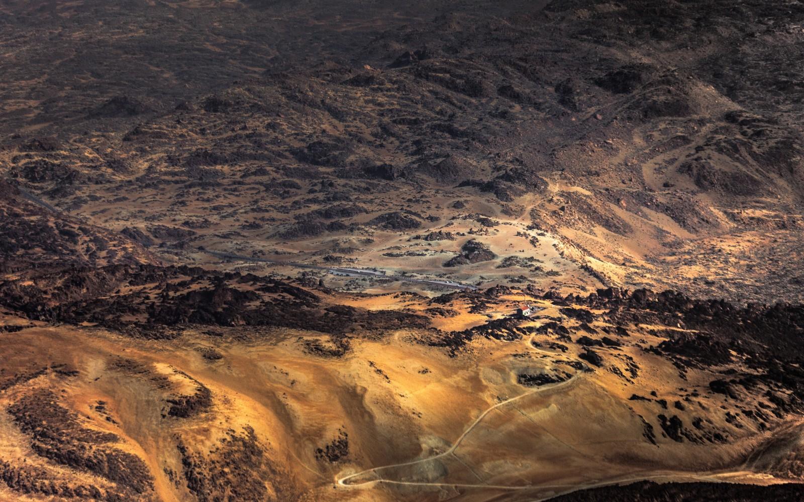
Teide National Park in Spain. Photo: Marek Piwnicki / Pexels
What is the best time to visit the Teide National Park?
Teide can receive you all year round given its dry weather conditions, however, we recommend best the months of May, June, July, August, September.
With low humidity levels, added to the lack of trade winds, it can be considered an arid climate that differs from the rest of the island and brings with it the presence of special fauna and flora.
Tenerife is characterized by its weather characteristics:
- It is the only place on the island where you can perceive the seasons in a marked way, with snow in winter for example.
- An active volcano generates a large number of microclimates that vary between the north and south of the island. Particularly in the Teide National Park during the day temperature variations can be experienced, which at 2000 m can start from 5°C and reach 20°C during the day. Therefore nights and early mornings are usually cool.
- During the summer it is important to be careful with strong solar radiation, with limited hours to play sports in the sun.
- Rain is scarce throughout the year with an average of 400 mm per year. During the winter, especially after a snowfall, beware of slippery surfaces.
In summary, both the spring and autumn seasons are the most recommended seasons to organize your hiking or mountain bike outings.
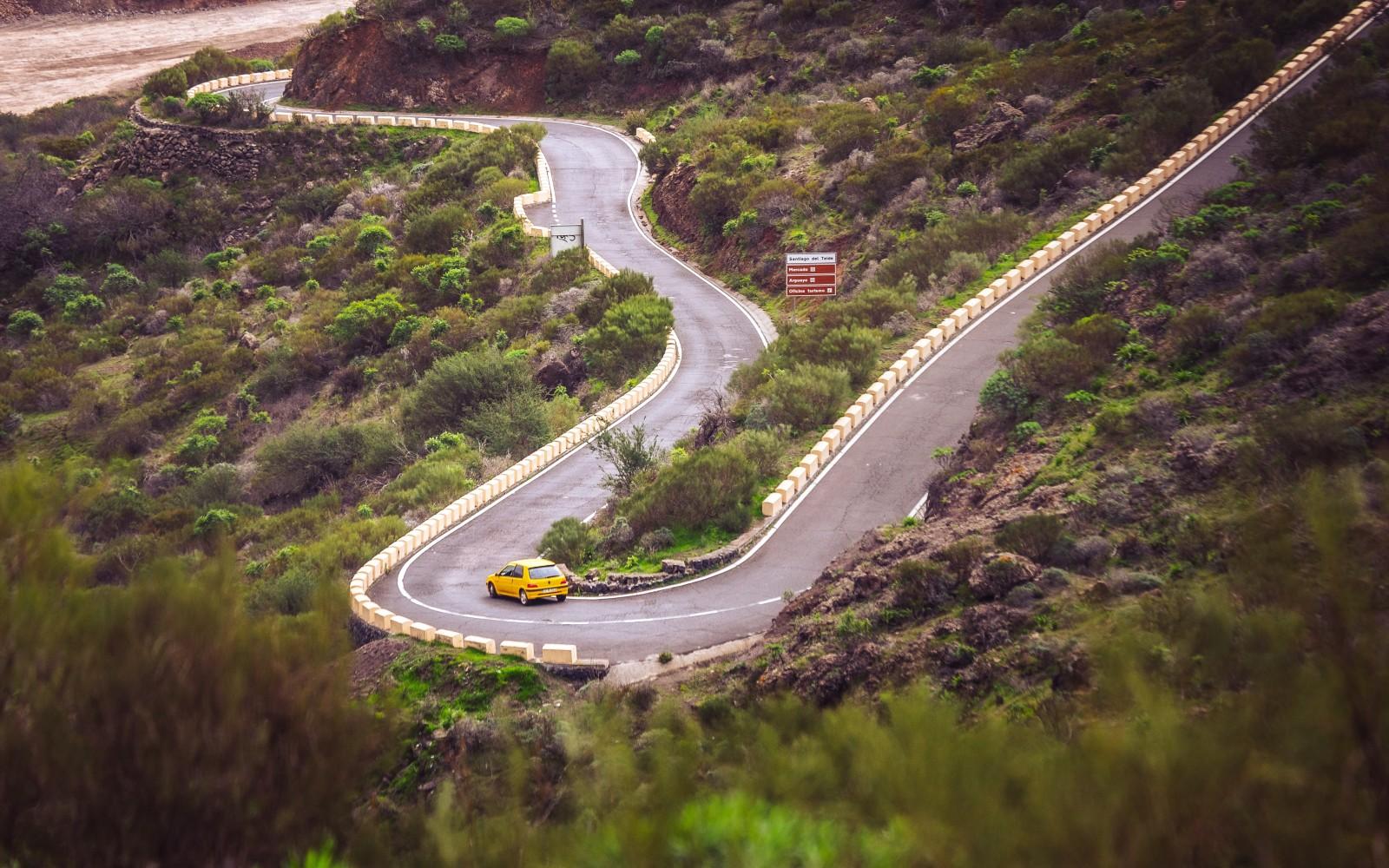
Teide National Park in Spain. Foto: Marek Piwnicki / Pexels
How to get to Teide National Park?
The fastest way to get to the park is from Spain. That is the first step. So you have to fly to Spain first anyway and then drive or take public transportation to the park. The entire trip takes no more than one day.
By airplane. The island of Tenerife has four airports, the southern one, Sur-Reina Sofía being the busiest with international flights. It is located 35 km from the Park and there is no direct access by public transport. Once on the island, you can rent a car or move by public transport.
By car. The Park is located 40 km from Santa Cruz de Tenerife, approximately 40 minutes. It has two parking lots, one at the base station of the cable car and the other at the beginning of trail no. 7.
By public transport. You can take the bus no. 348 from Puerto de la Cruz or no. 342 from Costa Adeje. To learn more about public transport in Tenerife, please visit the Titsa website, the city's transport system.
Teide has two visitor centers or information points:
Telesforo Bravo
Calle Dr. Sixto Perera Gonzalez, num. 25, El Mayorazgo, La Orotava
Tuesday to Sunday, 9 pm to 2 pm / 3:30 pm to 6 pm
+34922922371
[email protected]
El Portillo
TF-21, 38414, Los Realejos, Santa Cruz
Every day, except December 25 and January 1, 9 am to 6 pm
+34922922371
[email protected]

Teide National Park in Spain. Photo: Marek Piwnicki / Pexels
Where to stay in the Teide National Park?
There is a hotel inside the park - El Parador de Cañadas del Teide. Please book in advance since it is the only option at the moment to stay inside the park.
The Altavista Refuge is currently closed due to the COVID pandemic. It is located at an elevation of more than 3200m and has unique views to enjoy the sunrise in Tenerife. It has a capacity for 54 people, kitted with a kitchen, infirmary, bathrooms, and showers. However, it is essential to check if it is available before organizing the trip because it is not usually open throughout the year.
Finally, the hotel offer on the island is varied and for all budgets and types of visitors, you can choose the one that best suits your needs and reach the park by car or public transport as stated above.
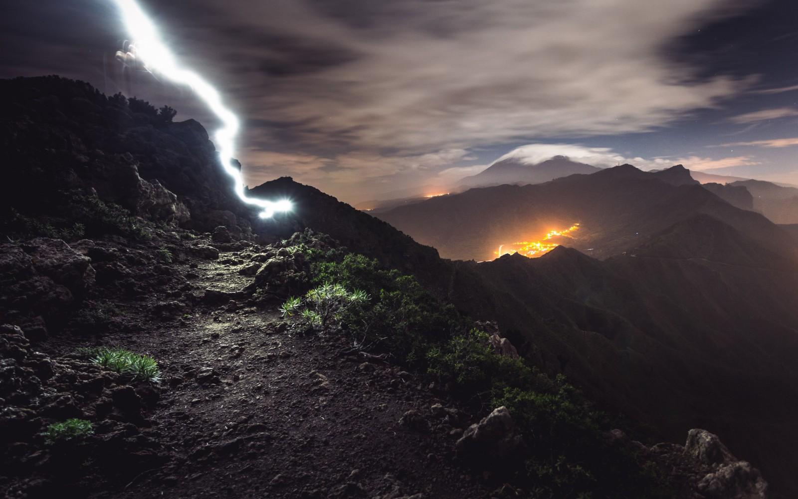
Teide National Park in Spain. Photo: Marek Piwnicki / Pexels
Where to find the weather forecast for biking in the Windy.app?
In Windy.app, you can create your bike route with the weather forecast for the entire route. You will see the three most important weather parameters: wind, precipitation, and temperature. Right on the app's home screen for all your favorite places at once. You don't even have to access each spot to see the weather forecast. This will help you avoid unexpected weather conditions.
1. Open the application and from the home screen click on the weather map icon.
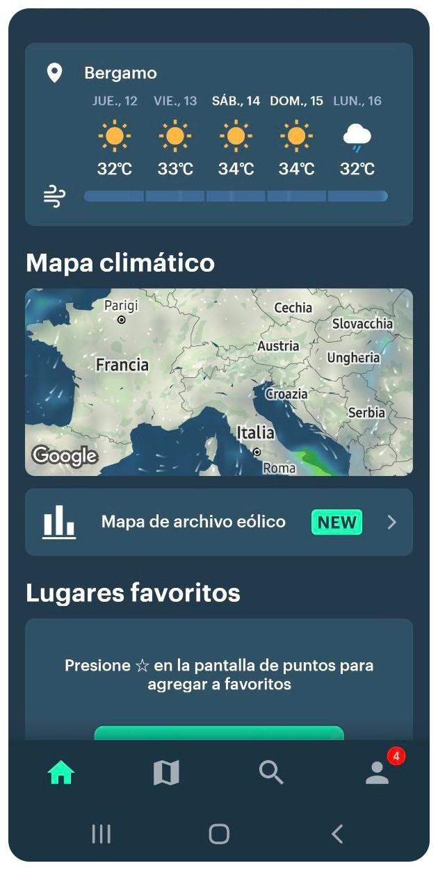
Cycling Routes With Weather in the Windy.app for Android
2. Once on the map, select the routes icon on the top left. Select the land option and then the navigation icon.
3. You can select the route by clicking on each available place. At the bottom, you will find the total distance traveled, and you can also select your practice day.
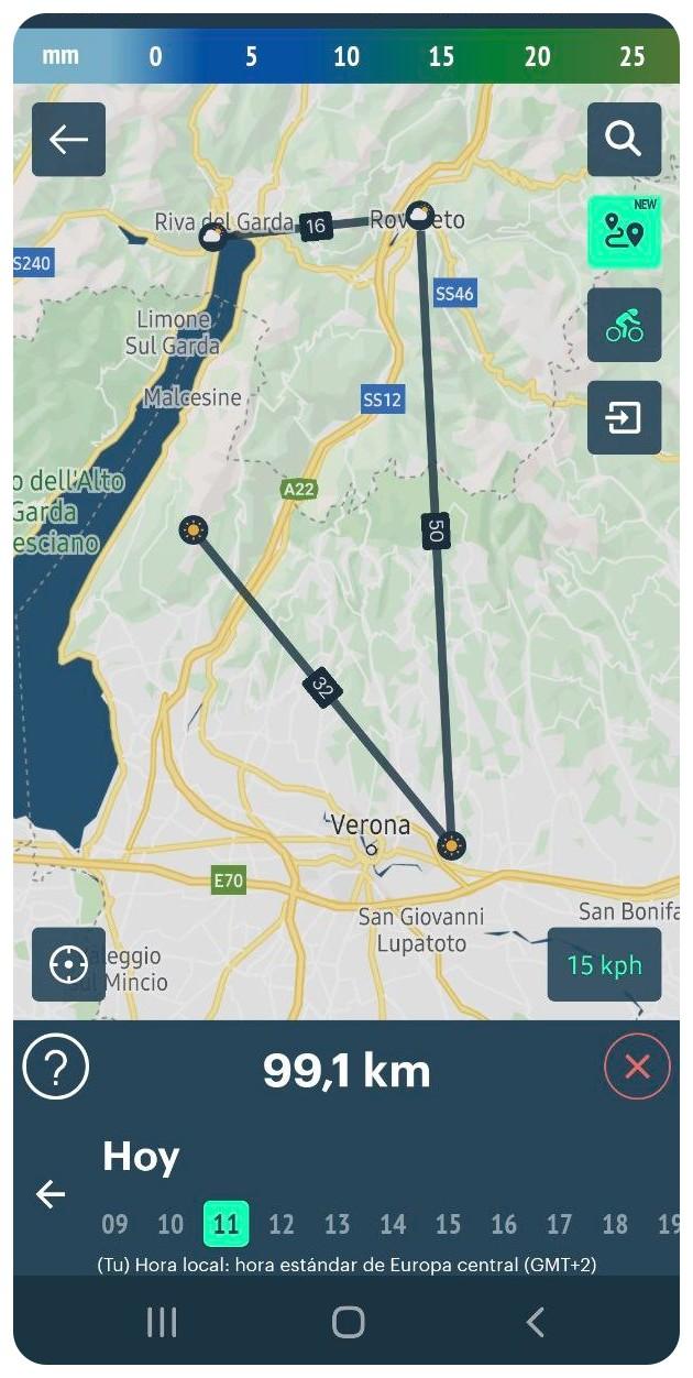
Cycling Routes With Weather in the Windy.app for Android
4. Lastly, if you click on the weather icon, which is a small sun, you'll be able to check weather information.
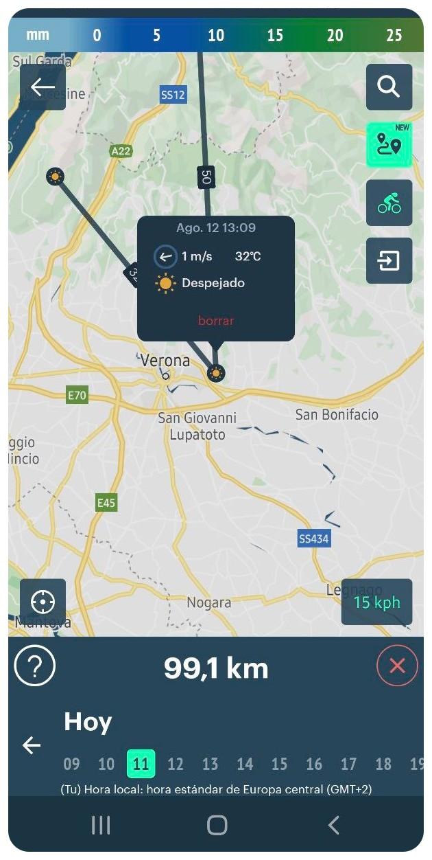
Cycling Routes With Weather in the Windy.app for Android
5. You can also click on the weather information to go to the preview of that specific place.
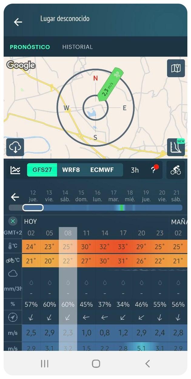
Cycling Routes With Weather in the Windy.app for Android
Text: Diana Marcela Zuluaga. Ivan Kuznetsov contributed to this article
Cover photo: Spain.info
You will also find useful
Hiking and Biking Routes With Weather — a brand new feature
Latest News
Professional Weather App
Get a detailed online 10 day weather forecast, live worldwide wind map and local weather reports from the most accurate weather models.
Compare spot conditions, ask locals in the app chat, discover meteo lessons, and share your experience in our Windy.app Community.
Be sure with Windy.app.


