
What are weather buoys and where they are applied
Weather buoys are one of several primary weather instruments for collecting data about the atmosphere, ocean, and other features of the Earth. Without them, modern meteorology since about the second half of the 20th century would not be what we know it today, so the quality of weather forecasts would also be lower. In this article, we’ll explore what weather buoys are and how they work.
Weather buoys definition
Weather buoys are the next most common type of weather instruments after weather stations, weather satellites, and weather radars.
But they appeared earlier than satellites and radars, and are still the main tool for collecting data on the state of the ocean, because, as the name implies, a buoy is placed on the water. It can be either the ocean itself, the sea, a bay, or a large lake. For example, there is a NOMAD weather buoy, designed to operate in extreme conditions near the US coast and on the Great Lakes.
The buoys also collect data on the atmosphere, the earth’s geomagnetism, and more. So it can be also called a "water weather station".
Windy.app user KiraKage on the den haag spot / Windy.app
The main types of weather buoys
There are two main types of weather buoys, depending on their construction, or rather how they are “attached” to the ocean: moored buoys and drifting buoys. This or that type of buoy or a mixture of buoys are also combined in networks to collect more data.
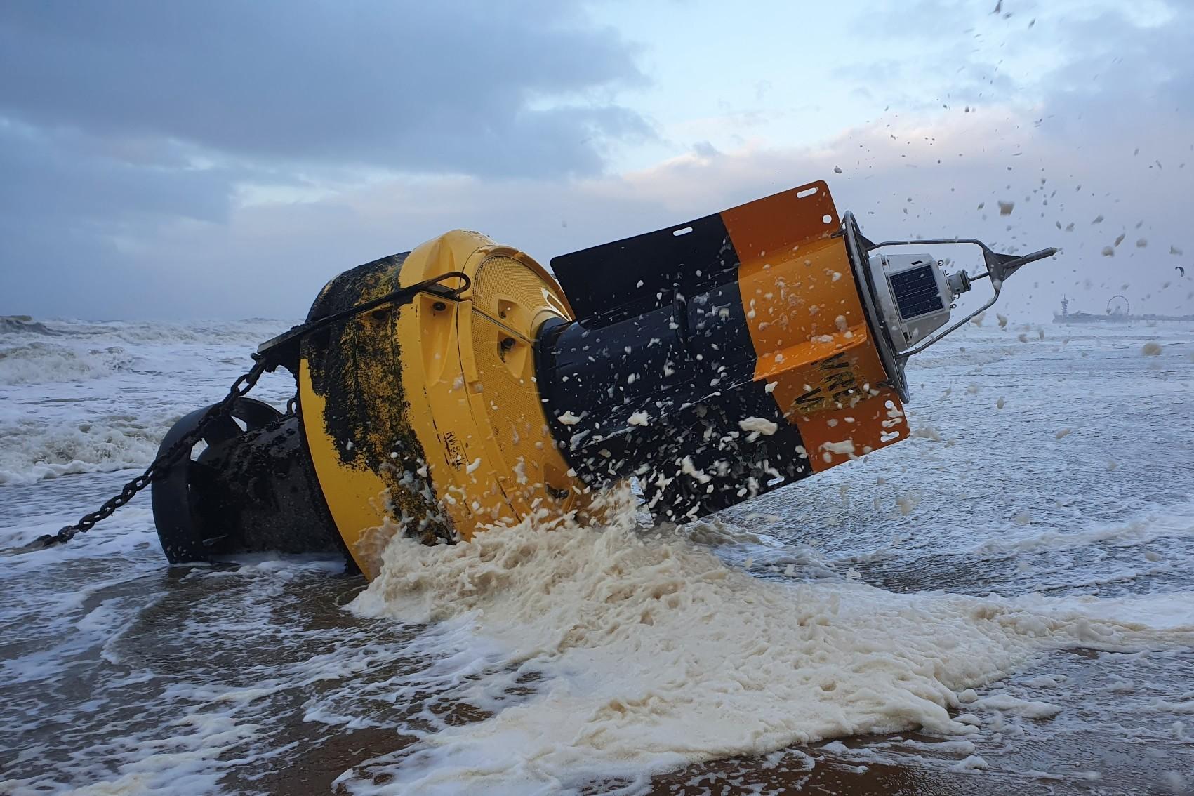
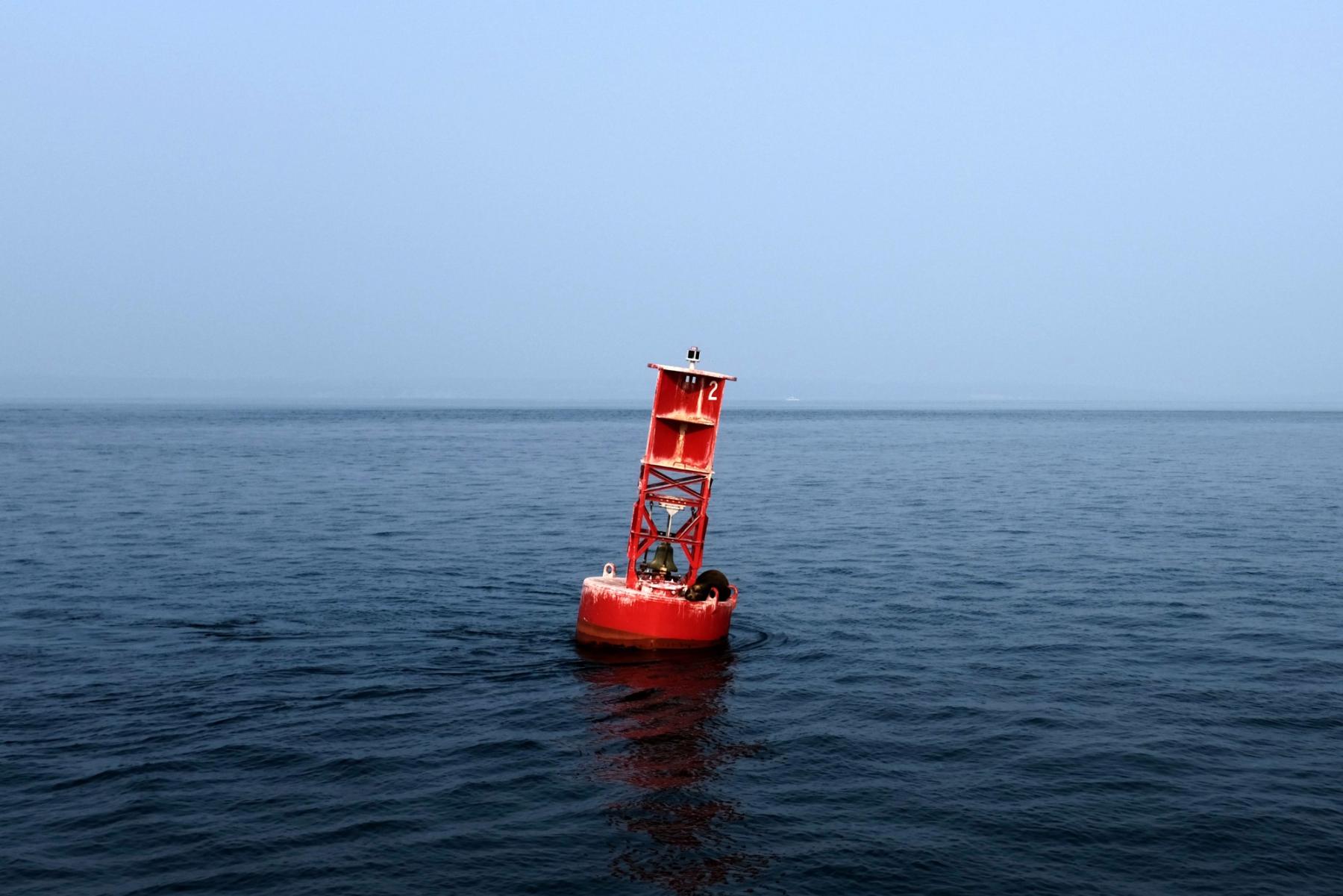
- Moored buoys are anchored to the ocean floor. Therefore, they gather information from just one place. Such buoys have been in use since 1951, but since the 1970s, when the number of meteorological ships decreased, they have become more important. Although it was actually the other way around: buoys supplanted ships because they are cheaper to operate and maintain. Moored weather buoys are also navigational aids in sailing. But as they have no direct navigational value, they are classified as special signs and are painted yellow, and show a yellow flashing light at night.
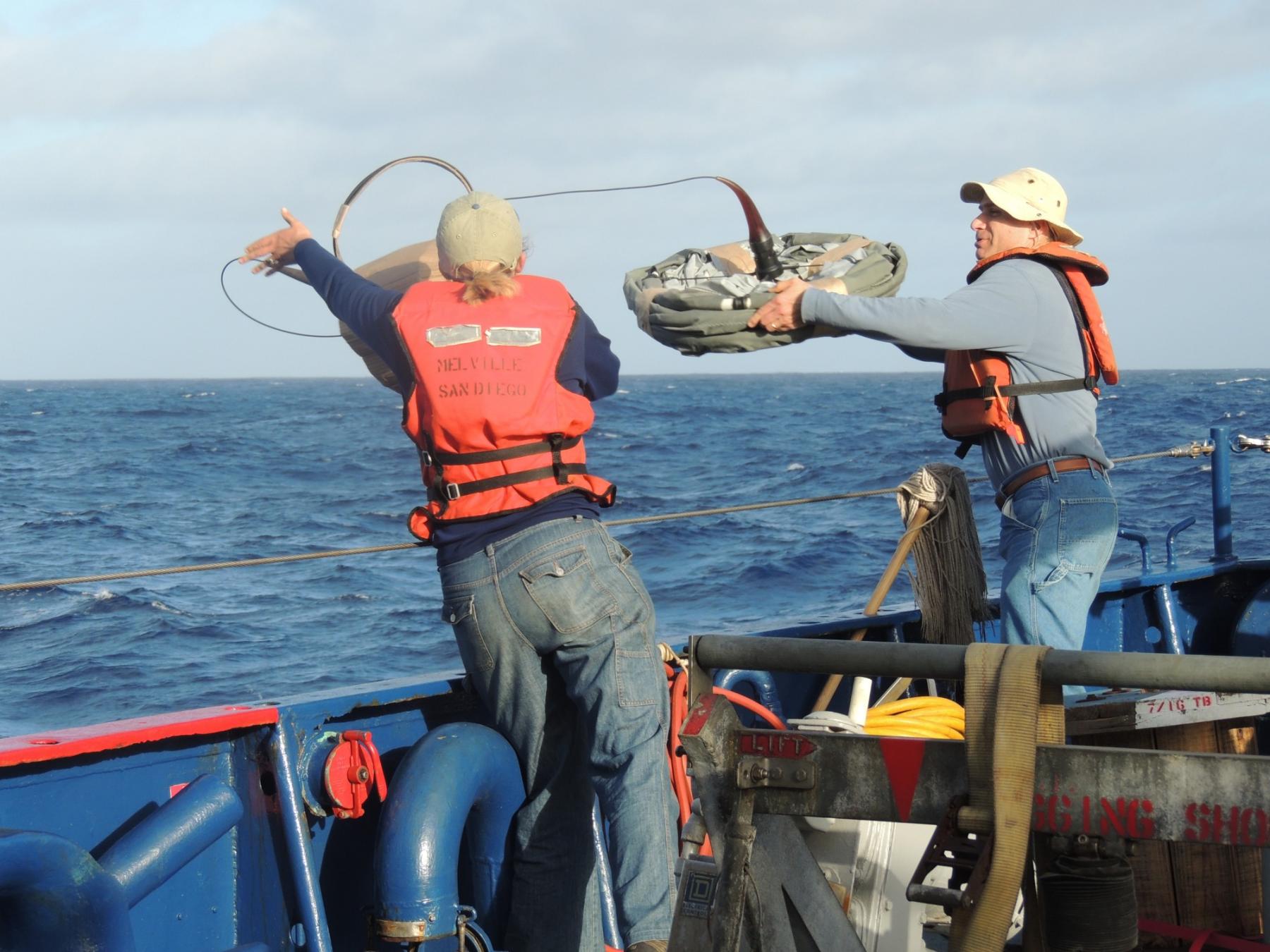
- Drifting buoys are their opposite: they move freely through the waves in open ocean currents, collecting weather information from different parts of the ocean. Such buoys have been in use since 1972. The first drifting buoys were used in the Sargasso Sea of the North Atlantic Ocean. This type of buoy is more frequent than the previous one. For example, on this map of the National Data Buoy Center of NOAA, you can see how many buoys are deployed and where. It shows 1,327 buoys along both coasts of North America, including Mexico and Canada, in South America, in Europe, and on the west coast of Africa. This is the approximate number of buoys in the world.
Girma Nigusse / Unsplash
Weather buoys networks
Weather buoys networks help to study large weather phenomena. For example, in the 1980s and 1990s, a buoys network in the Central and Eastern Pacific Oceans helped study the El Niño phenomenon associated with hurricanes. An example of such a system in Europe — the Irish Marine Data Buoy Observation Network. The network is managed by the Marine Institute of Ireland in collaboration with the UK Met Office. According to its description, “the network is designed to improve weather forecasts and safety at sea around the country. The buoy network provides vital data for weather forecasts, shipping bulletins, gale and swell warnings as well as data for general public information and research.” It includes six buoys designated by the letters M and numbers.
Design and working features of weather buoys
Weather buoys look like ordinary buoys at sea or floats but differ from them in their larger size and more complex construction. Moored buoys range in diameter from 1.5 to 12 meters (5–40 feet), while drifting buoys are 30–40 centimeters (12–16 inches), so the latter is much smaller.
Stationary large buoys as usual are made of metal, and traveling buoys are made of plastic and other lighter materials.
The buoys are powered by batteries, which, however, run out over time. For example, the very first weather buoys in the second half of the 20th century lasted a maximum of 8–10 days. But today they work more. Today the buoys often have solar panels on them.
Each weather buoy, regardless of its type, has coordinates, i.e. it has a GPS sensor attached to it, which allows you to track it.
Just like weather stations and weather satellites, buoys carry a variety of instruments for collecting weather and ocean data. So they collect the following information, as exemplified by the buoys of the same The Irish Marine Data Buoy Observation Network (IMDBON):
Meteorological data
- Air temperature
- Wind direction and wind speed
- Maximum wind gusts
- Atmospheric pressure
- Relative humidity
Oceanographic data
- Mean wave direction
- Wave height and wave period
- Maximum wave height and wave period
- Sea temperature
- Salt content of water (salinity)
But buoys also collect many other parameters: e.g. tides, geomagnetic parameters, and more.
Noaa / Unsplash
Data is collected and updated at least four times a day or shown in real-time, similar to weather stations. How real is the time? Well, according to IMDBON, “this typically means within an hour from when the observation is made.”
The raw data is processed and logged on the buoy and then transmitted by radio, cellular, or satellite to weather centers for use in weather forecasting and climate studies.
Yes, buoys are also being used for long-term weather data collection. There was one drifting buoy in the United States, which collected sea surface temperature data for 10 years from 1996 to 2006. This is the longest period of data collection for any drifting buoy.
Disadvantages of weather buoys
The main disadvantage of buoys are limited functionality and service life, as well as exposure to sea storms and hurricanes.
Compared with weather stations, buoys can be equipped with a smaller set of tools to measure a lesser number of weather phenomena. In particular, drifting buoys measure a smaller set of data compared to moored ones.
Typically, a buoy is a very rugged tool with long service life. They are generally difficult to damage, but in severe storms it is possible. For example, on August 8, 2005, hurricane Katrina damaged a 10 m (33 ft) buoy. This happened for the first time in the history of this type of weather instrumentation in the United States.
The 3 m (10 ft) buoy is expected to last more than 20 years, but with proper maintenance, they can last longer. Still, sooner or later the saltwater also causes the buoys to corrode over time and can fail.
Text: Ivan Kuznetsov, an outdoor journalist, editor and writer from the Dolomites, Italy, and Karelia, Finland, with 10 years of professional experience. His favorite sports are hiking, cycling and sauna. Read his other articles
Cover photo: Goh Rhy Yan / Unsplash
You will also find useful
How do we measure weather. The complete guide to weather instruments
Latest News
Professional Weather App
Get a detailed online 10 day weather forecast, live worldwide wind map and local weather reports from the most accurate weather models.
Compare spot conditions, ask locals in the app chat, discover meteo lessons, and share your experience in our Windy.app Community.
Be sure with Windy.app.


