
How do we measure weather. The complete list of weather instruments (with photos)
The weather forecast you see in the weather app or the website is just the tip of the iceberg. Figuratively speaking, it is followed by the larger central part — the weather model that makes the forecast, and the base — the meteorological data about winds, precipitation, and so on. But where does that data come from?
We collect weather data with various weather instruments. You can call them gadgets or devices in a modern way. There are more than two dozens of them, but they can all be divided into two groups: small and basic, and big and complex. An example of the first is the most common home thermometer to measure air temperature, an example of the second is weather stations that you probably know about, too, if you are interested in meteorology.
The first group of instruments have been around for centuries, but have not yet disappeared, it is still in active use. The latter was created relatively recently with the development of technology.
So let’s take a look at what weather instruments are and what are their main features. Follow the links to learn more about some tools, particularly the stations, satellites and radars that are the most interesting and common in meteorology today.

How de we measure weather: instuments. Valerya Milovanova / Windy.app
Small and basic weather instruments
The number of basic weather tools is roughly equal to the number of weather parameters. That is, usually one corresponding instrument is used to measure one parameter. These can be analog instruments as well as electronic ones, and there are more and more of the latter.
Thermometer
Thermometer is the smallest, simplest, and most common weather instrument everyone has at home, no matter how much you know about the weather. In meteorology and the natural sciences, a thermometer measures the temperature of the various environment: air, sea surface, soil, and more.
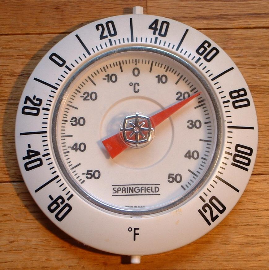
Thermometer. Photo: Wikipedia
Wind measurement instruments
There is more than one instrument for measuring wind, сonsidering that this is probably the most diverse weather parameter:
- Anemometer is the most common of these wind instruments. This is a small tool that usually consists of a base and three cups that rotate on the spire. In the process, they capture and measure wind speed and direction. Such instruments are also called "cup anemometers". What is important to know about them is that they are usually set at an altitude of 10 meters (32 feet) above sea level, which is the optimal altitude for measuring the wind. So that’s the wind you see in the weather forecast is always measured at this heigh.
- Wind meters or pocket anemometers are kind of like pocket thermometers. You can use them to measure the wind speed wherever you are. They are used extensively by many sportsmen for whom knowing wind speed is important: kitesurfers, paragliders, and others.
- Wind vane and windsock are two other old tools for measing wind direction. The first looks like a windmill with a sail coming off it; the second — literally like a sock that is filled with air. This is how we know the direction of the wind.
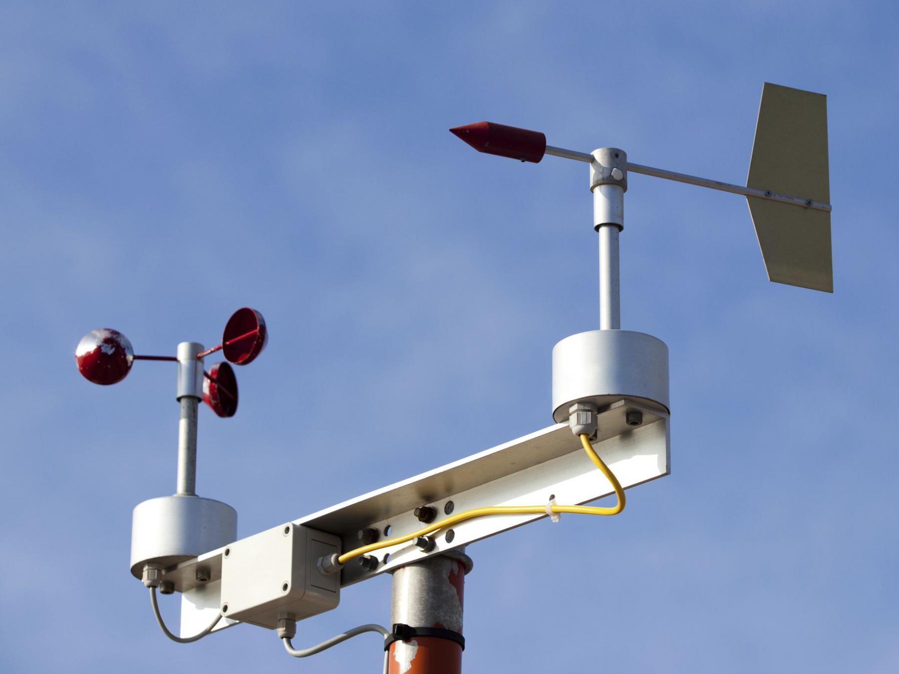
- Wind profiler helps us to measure the wind at every 1,000 meters (3,280 feet) above sea level, up to the extent of the troposphere between 8 and 17 kilometers (4.9 to 10.5 miles). The wind profilers use radar or sound waves (SODAR) to determine wind speed and direction. They may look like a nightstand but not always. Yes, we can rather classify this tool as big and complex than small and simple, but we list it here to collect all the wind measurement tools in one place.
Learn more about wind measurement instruments
Classical anemometer with a vertical pillar and three or four cups. Photo: Mayo5 / Getty Images

Wind meter. Photo: Wikipedia

Wind vane. Photo: Ginna Shernoville / Unsplash
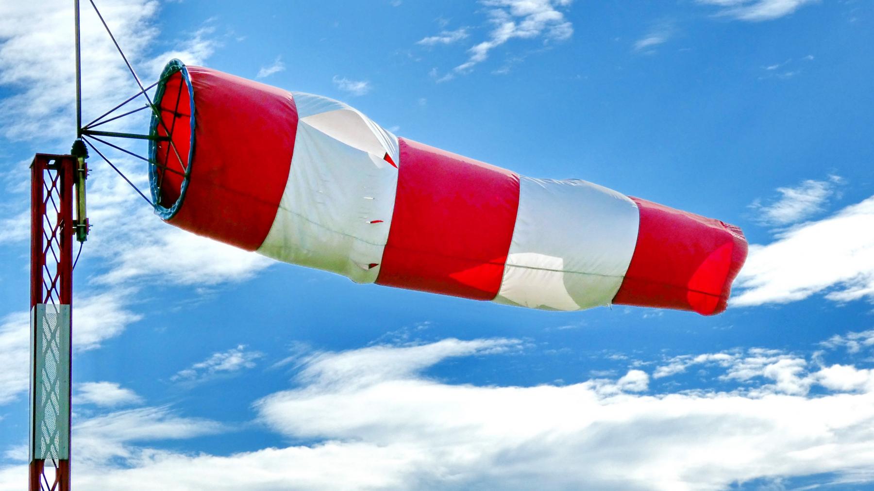
Windsock. Photo: Mark Konig / Unsplash
Wind profiler. Photo: Wikipedia
Precipitation measurement instruments
Several tools are also used to measure precipitation, another complex weather element with many types and features:
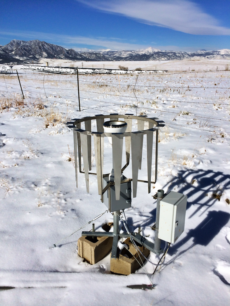
- Rain gauge also known as udometer measures the depth of liquid precipitation over a set period of time in a particular place. Rainfall amount is usually expressed in mm / inches, depending on the region of the world.
- Snow gauge is almost the same weather instrument as a rain gauge, but for measuring solid precipitation. Like the latter, it looks like a small device with a bowl to collect rain or snow, respectively. It is important to know that the correct data collection and measurement of precipitation is greatly affected by wind, which can carry water or snow out of the bowl.
- Disdrometer is used to determine the drop size distribution (distribution of the number of raindrops according to their diameter) and velocity of falling hydrometeors (any particulates of liquid or solid water in the atmosphere). Some disdrometers can measure types of precipitation such as snowdrops, and hail.
Learn more about recipitation measurement instruments

Rain gauge as part of weather station in Aktobe, Kazakhstan, Central Asia / Windy.app
Snow gauge. Photo: Ral.ucar.edu

Disdrometer. Aleksandra Kardaś / Wikipedia
Barometer
Barometer is another basic and common instrument that may well be in your home — ok, not in the living room, but somewhere in the garage. It is used to measure atmospheric pressure. An ordinary barometer is a round thing, similar to a compass, but they come in larger sizes and different designs. Some old barometers from the 19th and 18th centuries and earlier may even be collector's items.

An old German barometer. Photo: Wikipedia
Hygrometer
Hygrometer is a weather device that measures relative humidity, that is, the amount of water vapor in the air, in soil, or confined spaces. It is similar in appearance to a barometer, but can also be of different types and designs.
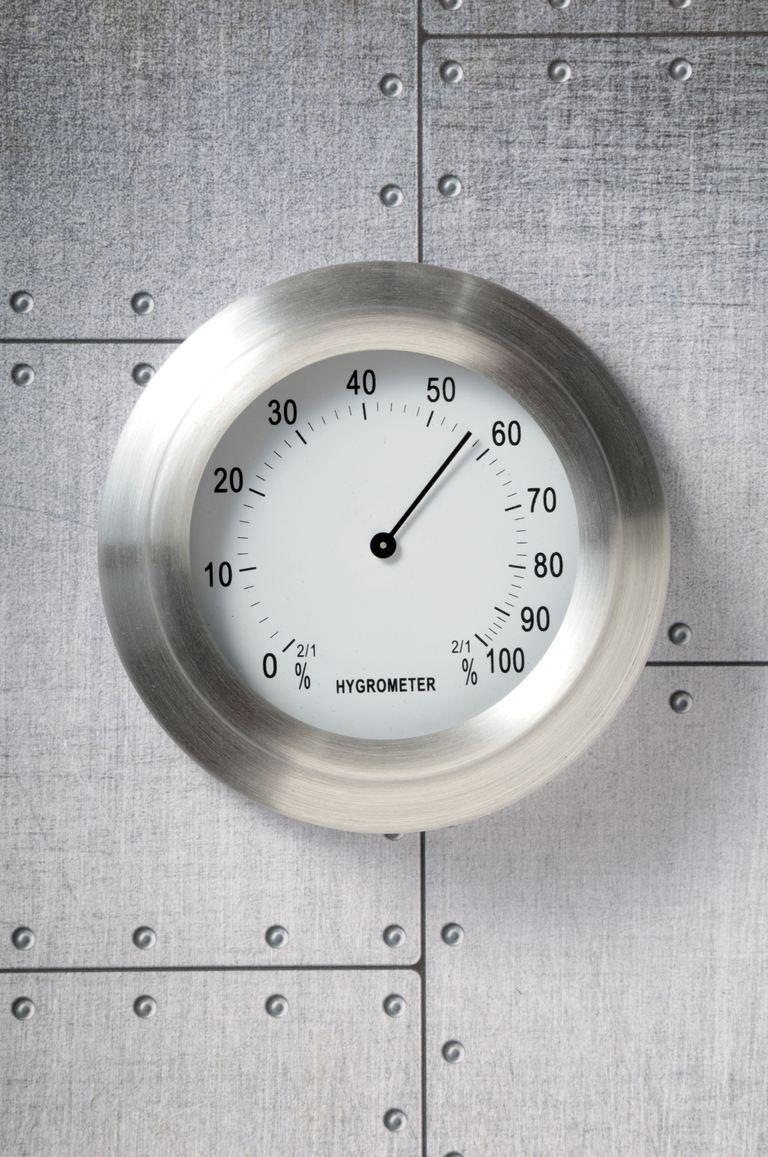
Hygrometer. Photo: Riou / Stockbyte / Getty Images
Transmissometer
Transmissometer is a weather tool for measuring visibility. You can see it on the airfield runways at an airports. Interestingly, transmissometers are also used in oceanology to measure the optical properties of water, that is, its transparency.

Transmissometer. Photo via Wise-geek.com
Pyranometer
Pyranometer is a device for measuring the amount of solar radiation, from which the Ultraviolet Index (UV Index) is then calculated. These things are very interesting because they look like little UFOs, even though they often look like regular box-shaped measuring devices.
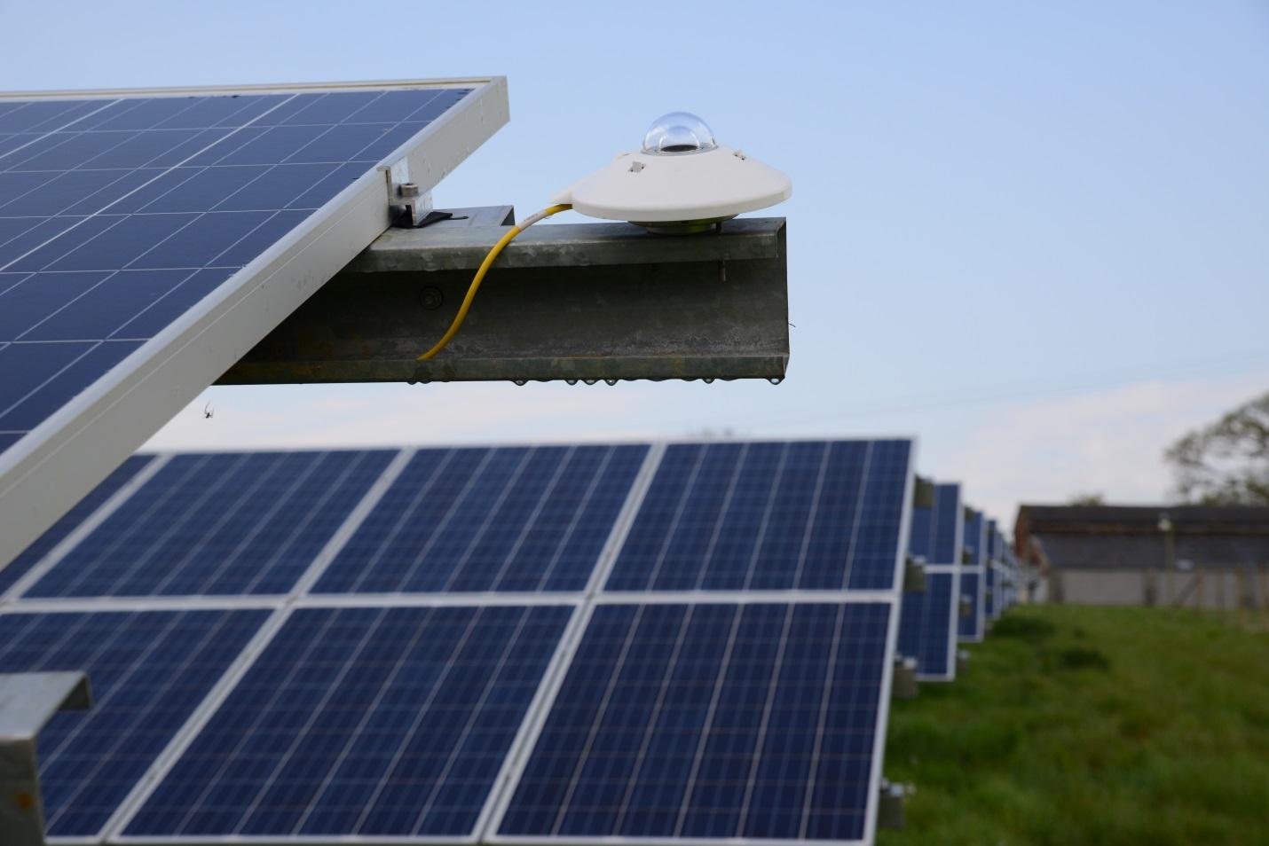
Pyranometer. Photo via Solarpowerworldonline.com
Ceilometer
Ceilometer is a weather instrument for measuring advanced weather parameters such as cloud ceiling and cloud base, that is, the height of the lower and upper limits of clouds, using a laser or other light source. Ceilometers are also used to determine the concentration of aerosols in the atmosphere. These parameters are not found in basic weather forecasts, they are useful for those who deal with aviation.
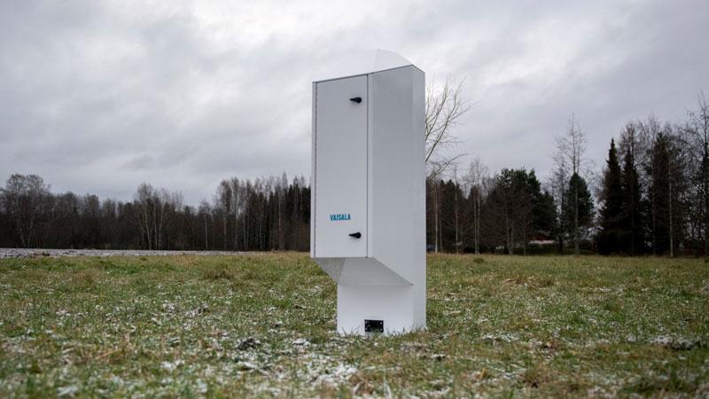
Lidar Ceilometer CL61. Photo: Vaisala.com
Lightning detector
Lightning detector is an instrument for recording lightning, a weather phenomenon from the atmospheric electricity. With their help, it is also possible to determine the coordinates of lightning strikes. Detection of lightning allows us to quickly respond to the threats associated with them, such as fires, failure of power grids, and so on.

Lightning detector. Photo via Thecolonytx.gov
Magnetometer
Magnetometer is an instrument for measuring magnetic field characteristics and magnetic properties of materials. The ordinary compass is a first and very simple type of magnetometer. More sophisticated magnetometers are used in geology for mineral exploration; navigation at sea, space and aviation; seismology (earthquake prediction), and other fields.
Magnetometer. Photo: Wikipedia
Large and complex weather instruments
Large and complex weather instruments differ from small and simple ones by the fact that they usually contain the latter. That is, they are a set of instruments. They can also be used not only on the ground but also on water and in the air, and even in the space. Thanks to this, they help to collect more data about the weather from a single source and collect this data more accurately and faster.
Among all the complex tools, there are three main ones: weather stations, weather satellites, and weather radars, and several additional ones which are less frequently used in modern meteorology.
Weather stations
Weather stations or meteorological stations are the most common instruments for weather observation and collecting different weather data. Meteostations are divided into two basic types and are also networked.
- Official weather stations belong to the national meteorological services of different countries and work according to certain standards, they are constantly monitored, updated, fixed, and so on. There are more than 40,000 official weather stations all over the world, which are part of the network of the World Meteorological Organization.
- Personal weather stations are stations, which you can set up in your home to get real-time weather data for your particular area. Because of this they are often called "home weather stations". Some of them also allow you to make a simple weather forecast.
- Weather stations networks, as the name implies, are systems of multiple stations. They are extremely useful for gathering information about large atmospheric phenomena such as weather fronts and pressure systems. Networks can be either official or personal, or a combination of the two.

Researchers from the University of Chicago and the University of Wisconsin install weather and Global Positioning System instruments on Iceberg B-15A. It's the first time an iceberg has been monitored like this, and the data will allow an unprecedented understanding of how giant bergs make their way through the waters of Antarctica and beyond. Photo: Wikipedia
Weather satellites
Weather satellites are satellites launched by man for the purpose of collecting weather data from space. They contain a set of tools that allow you to learn both basic weather parameters like air temperature, precipitation and wind, and advanced ones about, for example, snow and ice cover of the Earth, large-scale fires or volcanic eruptions and the like, which are better “seen” from space, as well as geomagnetic storms. Weather satellites together with data reception and processing stations form the meteorological space systems of different countries.
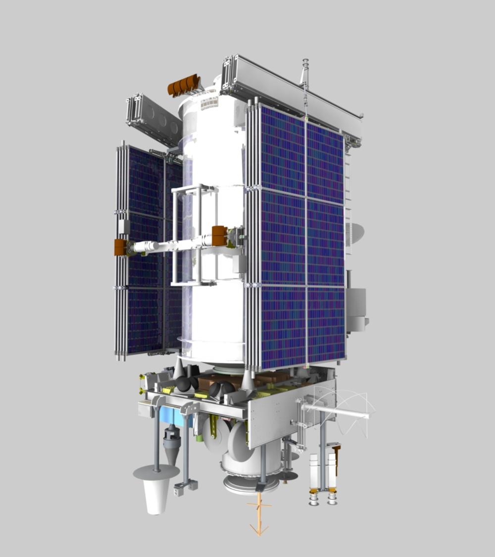
Meteor-M meteorological satellite No. 1 folded before deployment in orbit. Photo: Wikipedia
Weather radars
Weather radars or Doppler weather radars are used to determine the location of water-bearing clouds and their trajectory, so they are indispensable for predicting heavy rains, thunderstorms, tornadoes, snowfalls, and other types of dangerous weather. So radars are crucial to making accurate real-time “now cast” weather forecasts of precipitation. Typical radar is a four-story building size. There is a huge ball at the top of the radar — this is a shelter for the antenna that is inside. Its radius of action in the atmosphere is on average 200–250 kilometers (124–155 miles).

Weather radar under construction in Puerto Rico. Photo: FEMA / Eduardo Martinez / Vertical magazine
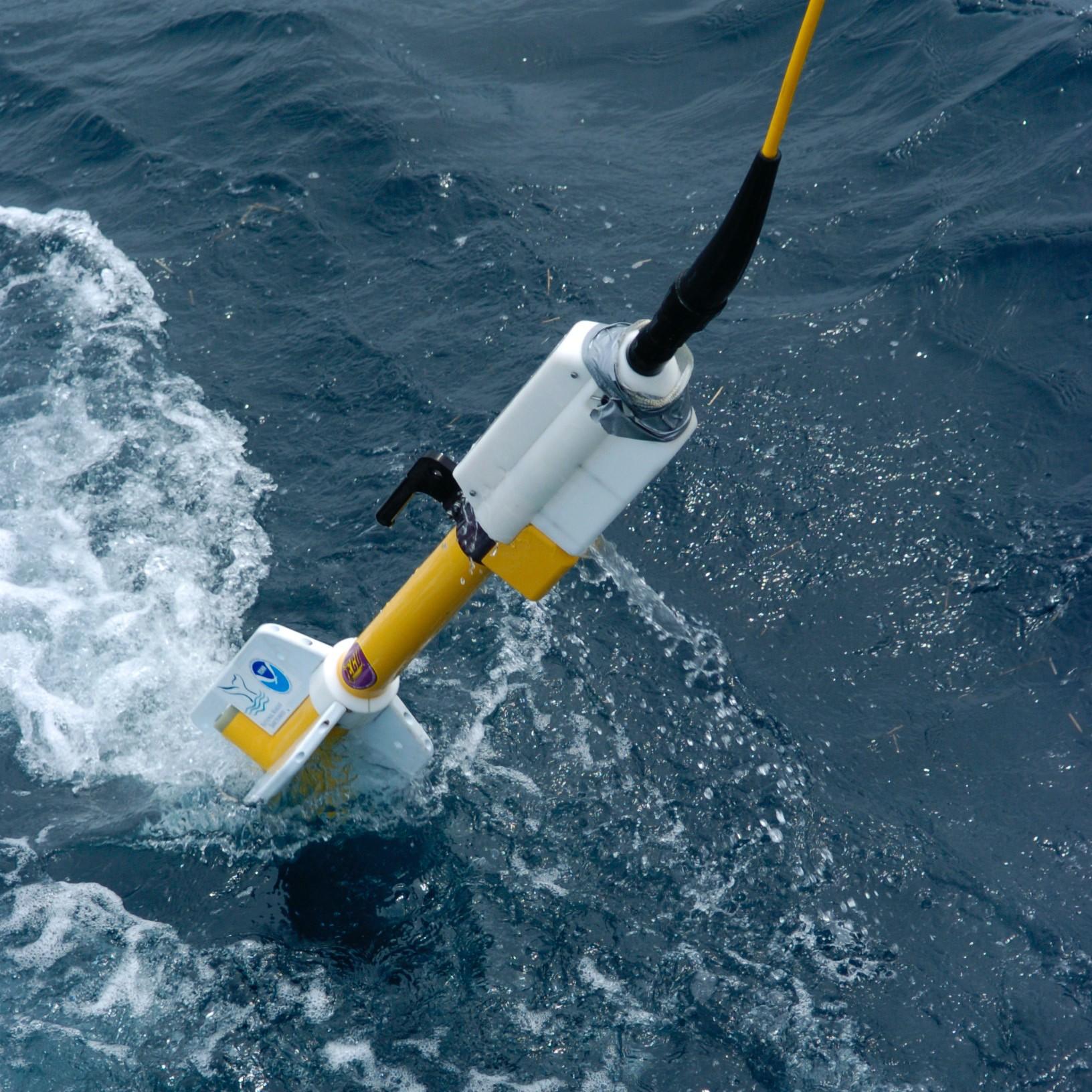
Weather buoys
Weather buoys are the fourth most common type of weather instruments. They look like floats in the water and collect data not only about the weather, but also about the world’s oceans and their individual parts (seas, bays, and so on). There are three main types:
- Moored buoys are anchored to the ocean floor. Therefore, they gather information from just one place.
- Drifting buoys are their opposite: they move freely through the waves in the open currents, collecting weather information from different parts of the ocean. This type of buoy is more frequent than the previous one. There are about 1,300+ of these buoys in the world.
- Weather buoys networks also help to study large weather phenomena. For example, in the 1980s and 1990s, a buoys network in the Central and Eastern Pacific Oceans helped study the El Niño phenomenon associated with hurricanes.

Weather buoys. Photo: NOAA / Unslplash
Weather balloons
Weather balloons are traditional weather measurement devices consisting of three parts: a rubber or plastic shell (balloon) filled with hydrogen or helium; a container with data collection equipment; and the string connecting the first two parts. Such balloons are launched into the air regularly to collect data on air pressure, humidity, temperature, and, in particular, wind speed at different altitudes, which is not possible with weather station located on earth. The altitudes can reach 30–40 km (18.6–24.8 miles) or "near space" between the Armstrong limit (18–19 km / 11–12 mi) and the Karman line (85 km / 53 mi). After the creation of radio communications, weather balloons were equipped with radiosondes that transmit weather data directly to the ground. Before that, the ballon had to descend before people could collected the data from it.
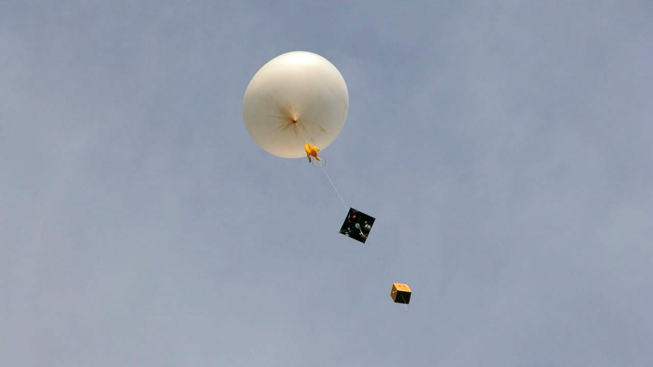
Weather balloon. Photo: Wikipedia
Weather aircrafts
Weather aircrafts are military planes of the national air forces that fly for the specific purpose of collecting weather data. Before the advent of weather satellites, planes were the only means of tracking tropical cyclones — hurricanes and typhoons — but still, satellites do not collect all the data, especially from inner parts of cyclones. That's why planes are still in use today. Groups of such aircraft (squadrons) are called Hurricane Hunters and Typhoon Chasers. Weather planes are also collect data about thunderstorm genesis, low cloud and fog formation, turbulence and jet streams location and intensity, conditions leading to aircraft icing and others. The WMO website even has a page devoted to aircraft-based meteorological observations benefits to aviation.
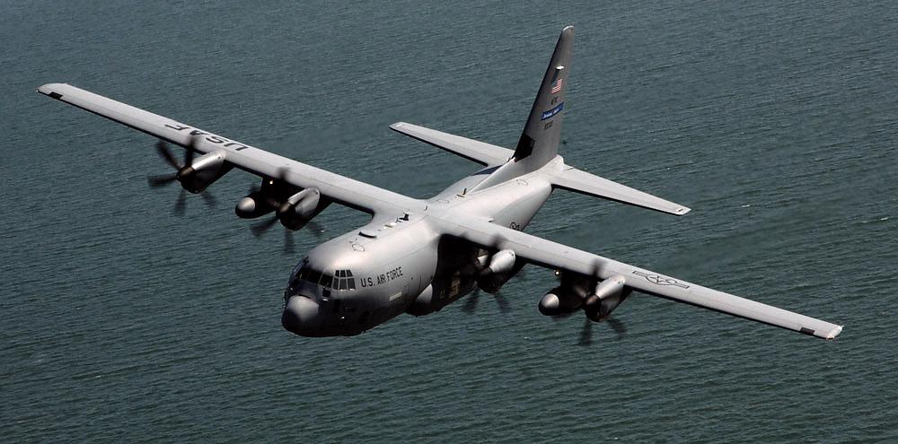
Weather aircraft and hurricane hunter "WC-130 Weatherbird". Photo: Wikipedia
Text: Ivan Kuznetsov, an outdoor journalist, editor and writer from the Dolomites, Italy, and Karelia, Finland, with 10 years of professional experience. His favorite sports are hiking, cycling and sauna. Read his other articles
Cover photo: Launching an ozonesonde balloon by NOAA / Unsplash
You will also find useful
The collection of articles about weather forecasting
The collection of articles about wind
What are weather satellites and how do they help us get weather data
What are the precipitation measurement instruments and how they work
Latest News
Professional Weather App
Get a detailed online 10 day weather forecast, live worldwide wind map and local weather reports from the most accurate weather models.
Compare spot conditions, ask locals in the app chat, discover meteo lessons, and share your experience in our Windy.app Community.
Be sure with Windy.app.


