How mammatus clouds form
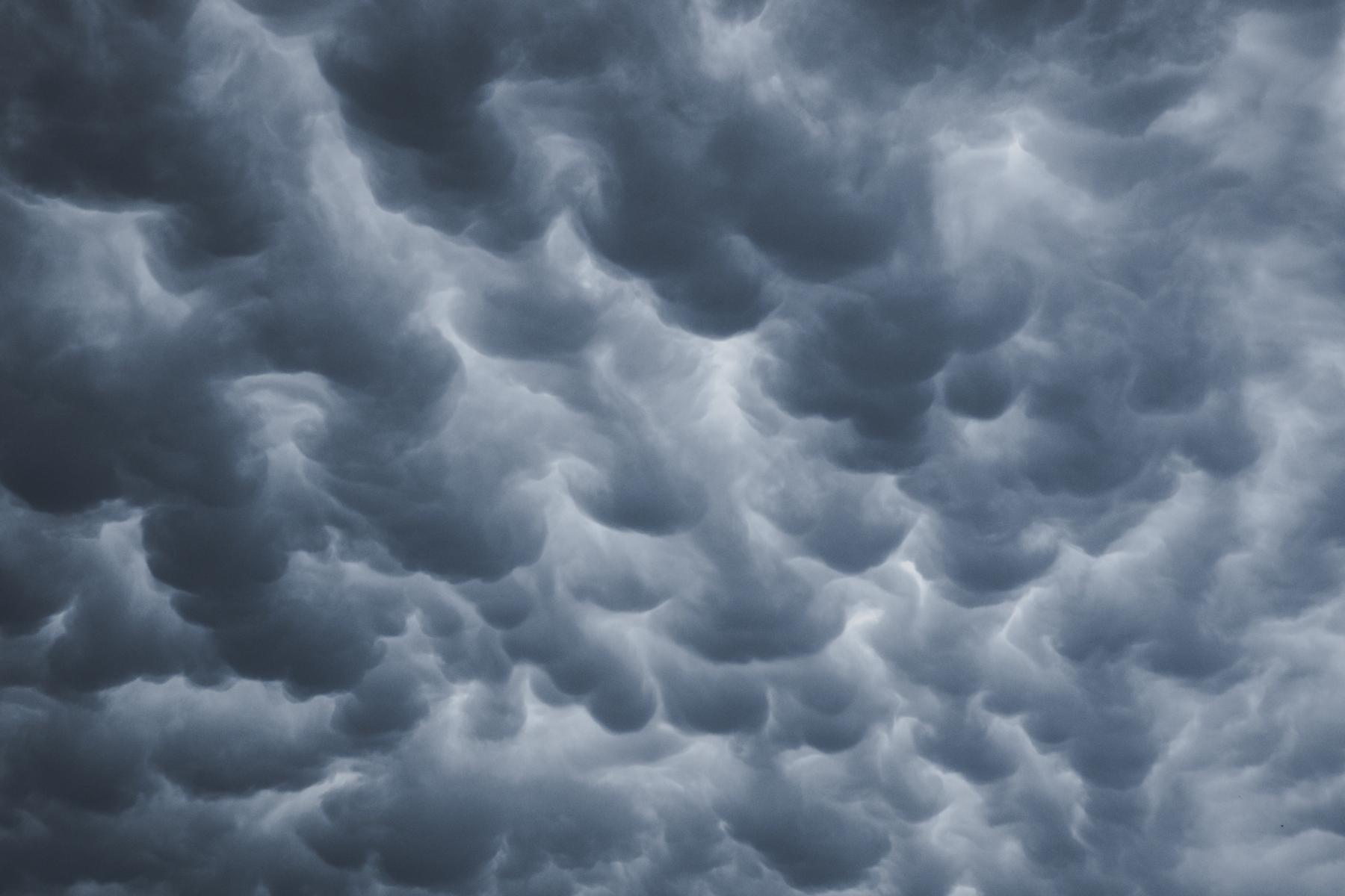
Mammatus clouds — they have such a strange name because they look like a cow’s udder. In this new lesson of the Windy.app Meteorological Textbook (WMT) and newsletter for better weather forecasting you will learn what are mammatus clouds and how do they form.
What are these clouds?
Mammatus clouds are not clouds in the traditional sense. These are small ‘pouches’ that appear on the bottom of cumulonimbus clouds. They can also form on other types of clouds, but only if but only if processes in them are similar to cumulonimbus clouds.
Mammatus clouds have a cellular structure. Each cell (i.e. each ‘pouch’) is about a kilometer wide. They consist mainly of ice, but can sometimes contain drops of water.

Mammatus clouds at sunset. John Dame / Unsplash
How do these clouds form?
Mammatus clouds also don’t form like the others. They can only appear on a large cumulonimbus cloud with a developed anvil.
Inside this cloud, there are areas where the air is much colder than the air outside, making the air in the cloud descend. And if it descends under the cloud, it will take the particles of water and ice the cloud consists of, forming the mammatus cloud.
When descending, the air heats up, so at some point mammatus clouds stop, and just remain hanging from the parent cloud.
.jpg)
Rayleigh—Taylor instability: the lighter fluid is pushing the heavier fluid. Mammatus clouds form according to a similar mechanism. Illustration: Valerya Milovanova / Windy.app
Why does the air in a cloud descend?
We don’t know for sure. There are two versions that are considered as the main ones.
According to the first version, the anvil of the cumulonimbus cloud is the main cause of the mammatus clouds’ formation. The air in the anvil cools drastically and begins to descend, passing through the entire cumulonimbus cloud.
But it turns out that if you give a forecast for the appearance of mammatus clouds, based on this version, it won’t be able to predict all of them.

Photo: Felipe Palacio / Unsplash
In the second version, precipitation is considered the main cause. Rain appears at the top of a cumulonimbus cloud in the form of ice crystals. As it falls through the cloud down, it melts into a drop.
At the bottom of the cloud, the drops begin to partially evaporate. As a result, the surrounding air becomes cool and heavy and begins to descend. Moreover, drops can take some of the air with them due to friction force, which also causes its descent.
But this version is the other way around. Sometimes it predicts that a mammatus cloud will appear, but it doesn’t.
Scientists are still searching for a generally accepted theory. Most likely, it will eventually combine several existing versions at once.
What to expect from mammatus clouds?
By themselves, mammatus clouds do not affect us in any way. But they usually appear under massive cumulonimbus clouds. Clouds like this can lead to heavy rainfall, hail, windstorms and thunderstorms. That’s why, mammatus clouds are the heralds of storms.

Often, it is mammatus clouds that appear before the storm. Photo: Colin Lloyd / Unsplash
In the Windy.app forecast, the CAPE index is ‘responsible’ for the likelihood of extreme weather events like showers, thunderstorms and squalls. The higher it is, the more likely all these phenomena are. You can find this forecast in the YACHT profile, but it can be useful not for more than just sailors!
Text: Windy.app team
Illustration: Valerya Milovanova, an illustrator with a degree from the British Higher School of Art an Design (BHSAD) of Universal University
Cover photo: Karsten Wurth / Unsplash
You can aslo find useful
Explore the different types of clouds. They will help you predict the weather
Explore the different types of precipitation. Rain and snow are just the beginning
Latest News
Professional Weather App
Get a detailed online 10 day weather forecast, live worldwide wind map and local weather reports from the most accurate weather models.
Compare spot conditions, ask locals in the app chat, discover meteo lessons, and share your experience in our Windy.app Community.
Be sure with Windy.app.


