
Explore the different types of clouds. They will help you predict the weather
One of the most obvious weather phenomena, clouds, is not a single entity, but more than a dozen different kinds of clouds. You yourself have noticed one or the other, but most likely you do not know how they differ from each other and what kind of weather they bring with them. Yes, you can predict the weather by the kind of clouds you see. In this new lesson, we're going to break down the main types of clouds. Follow the links to read the lesson about this or that type.
* * *
The WMO has created an international cloud atlas in which it has identified 10 main types of clouds called genera. These main types are divided into three levels, depending on the part of the atmosphere in which they are located: High clouds (HC), Middle clouds (MC) and Low clouds (CL). We will highlight them in bold font in this lesson, because, of course, there are more than 10 types of clouds.

Types of clouds. Illustration: Valerya Milovanova / Windy.app
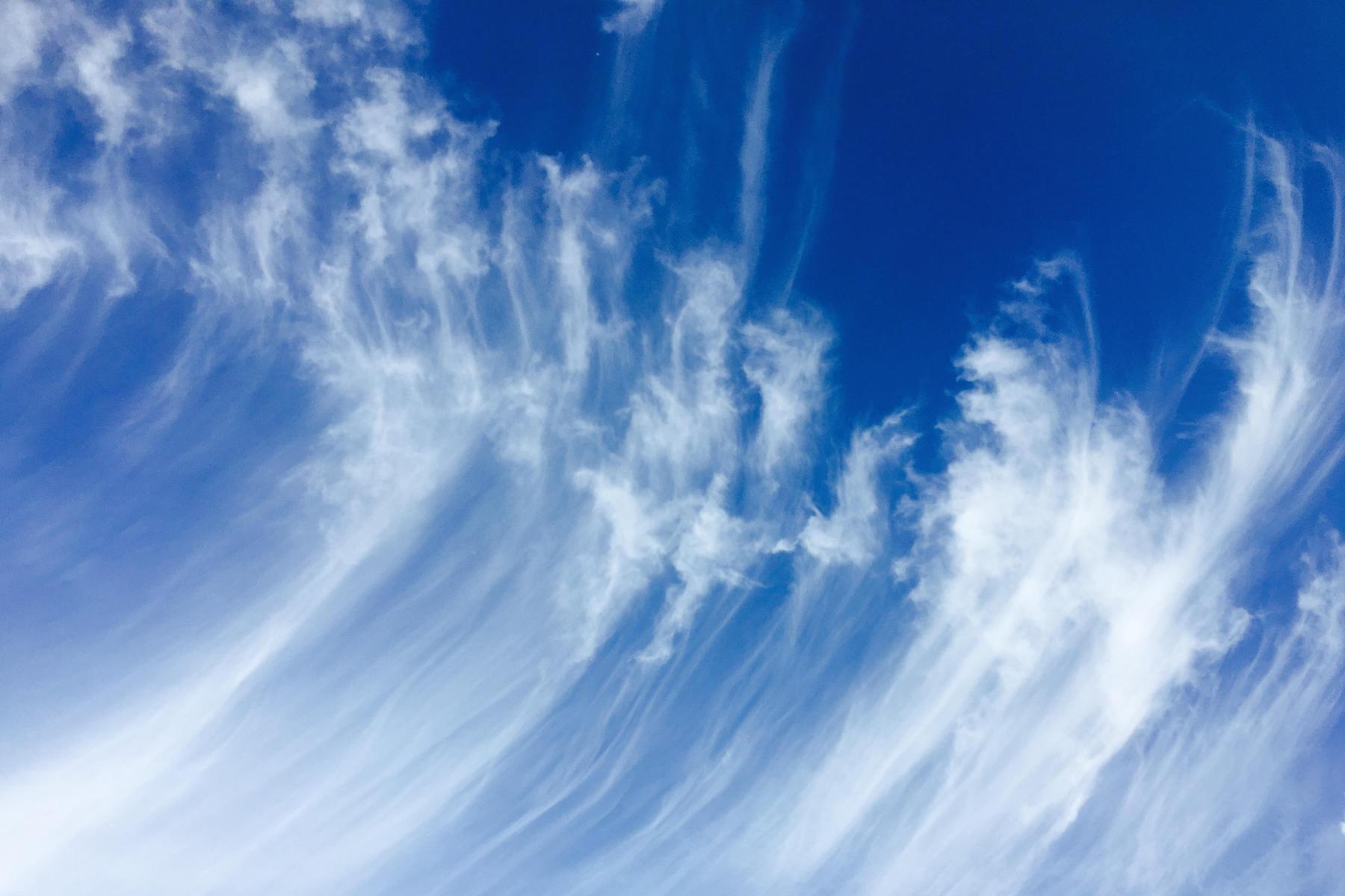
High clouds (CH): cirrus-, cirro
Most of high clouds are cirros and cirrus. If you see one of this prefixes, then this type of cloud belongs to the high. They can be seen at any time of the year at an altitude of 6000 to 12000 m (20000 — 40000 ft). They look like individual clouds in the form of thin threads or narrow bands. Often such clouds appear in front of a warm front, indicating an impending change in the weather. Technically, clouds produce precipitation, but due to the high altitude they do not reach the ground, and evaporate. The high type of clouds include:
- Cirrus uncinus clouds
- Cirrocumulus
- Cirrostratus
- Noctilucent clouds
- Nacreous clouds
- Anvil clouds
Cirrus uncinus clouds
Cirrus uncinus clouds. Photosforyou / Pixabay
The cirrus uncinus clouds are the precursors of weather changes. They are a form of cirrus clouds. They stretch across the sky in the form of parallel thin threads, which end with a ‘curl’. The name is derived from Latin, meaning ‘curly hooks’.
Learn more about cirrus uncinus clouds
Noctilucent clouds or night-glowing clouds
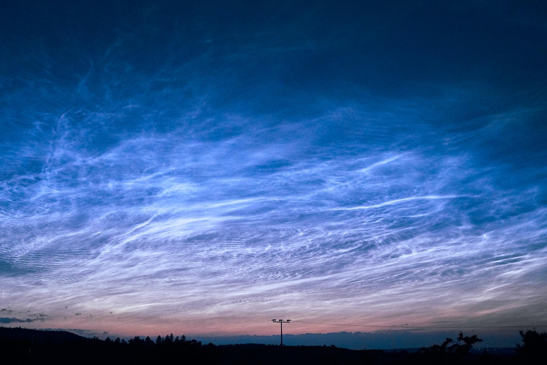
Noctilucent clouds. Joshua Humpfer / Unsplash
Those are noctilucent clouds. They are often called night-glowing clouds. Noctilucent clouds appear in the sky only at night and only in warm seasons. In the Northern Hemisphere they appear from May to September, and in the Southern Hemisphere - from November to March.
Learn more about noctilucent clouds
Nacreous clouds or polar stratospheric clouds
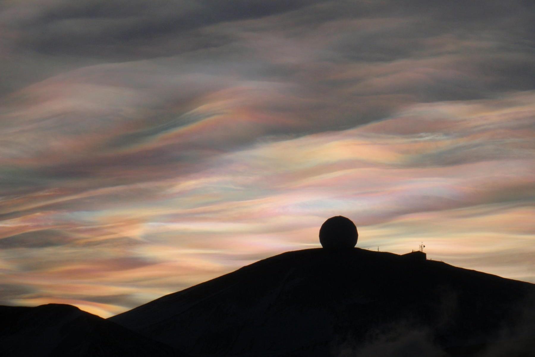
Polar stratospheric clouds. Pixabay
Polar stratospheric clouds also called nacreous clouds because of their unusual color are form at Polar latitudes. This is an extremely rare phenomenon! Because of this, there has always been a lot of interest in these clouds. And also because of the painting by the world famous Norwegian artist Edvard Munch.
Learn more about polar stratospheric clouds
Anvil clouds
.jpg)
Anvil clouds. Music4life / Pixabay
Sometimes a mass of warm air can rise to such a height that it encompasses the entire lower layer of the earth's atmosphere (that is, the troposphere). Such monsters grow to 15–18 km up. But when it reaches the tropopause, the cloud stops growing and, due to strong winds at this height, begins to blur, forming the shape of an anvil cloud.
Medium clouds (CM): alto-
Medium clouds spread out in thin but wide layers of mostly gray color across the sky. They can be seen at an altitude of 2000 to 6000 m (6500 — 20000 ft). Medium clouds very rarely bring precipitation, but if this happens, they do not reach the ground. The exception is nimbostratus: it drags the whole sky dark gray and precipitation can go up to several hours until this front passes. The medium type of clouds include:
- Altocumulus
- Altostratus
- Nimbostratus clouds
Nimbostratus clouds
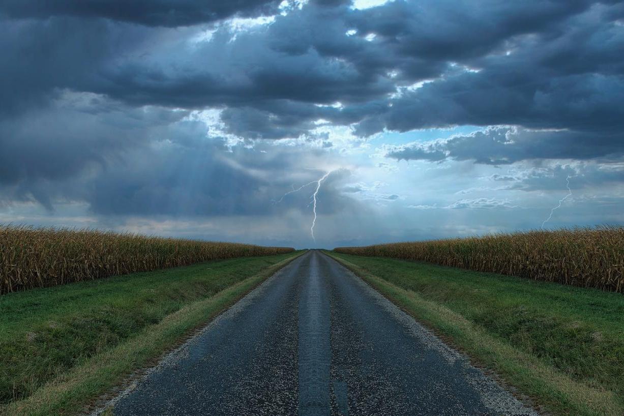
Road and Nimbostratus clouds. Saundelr / Pixabay
Nimbostratus clouds are dense, grey, featureless clouds which produce persistent and often heavy rain, snow or ice pellets. Nimbostratus are low level clouds and their base generally lies between 100 m and 1000 m but could rise to middle level up to 2000 m and even a bit higher.
Learn more about nimbostratus clouds
Low clouds (CL): cumulo- (vertical), strato- (horizontal)
Low clouds look the most massive of all — these are large clouds that occupy the entire sky. Some of them are fluffy and voluminous, for example, cumulus or cumulunimbus, while others, on the contrary, are low, thin and cover the entire sky. You can see them at an altitude of up to 2000 m (6500 ft). Basically, low clouds do not bring precipitation, they are harbingers of good weather. But it happens that one kind of clouds smoothly grows into another, and then precipitation falls. The low type of clouds include:
- Cumulus clouds
- Cumulonimbus clouds
- Stratocumulus
- Stratus
- Lenticular clouds
- Virga clouds
- Mammatus clouds
- Wave clouds
Cumulus clouds
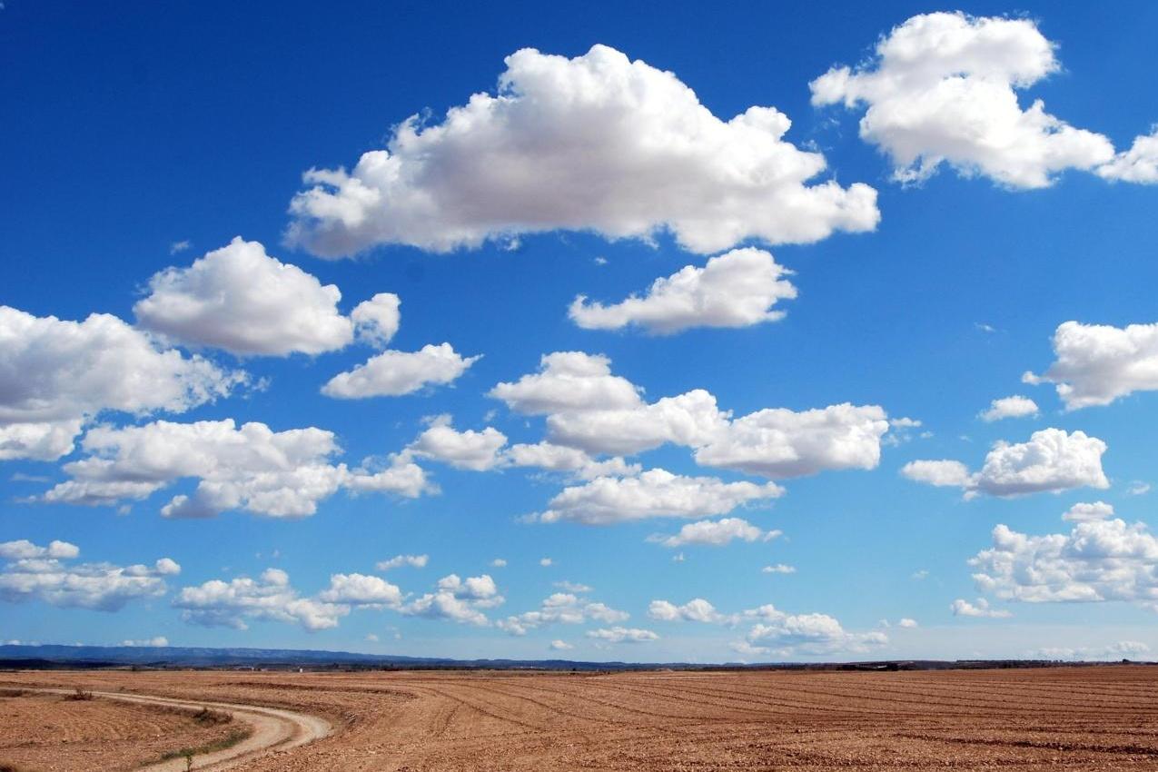
Cumulus cloud. Pcdazero / Pixabay
Cumulus cloud is one of the most common and distinctive types of cloud. Cumulus clouds are mostly spotted in fair weather conditions, but they can also be a precursor of stormy weather. On a sunny day we tend to see cumulus clouds looking like floating cotton wool balls. These puffs of cotton strewn around the sky are actually low-level clouds with a flat base. That's why cumulus clouds are often called "Cotton wool in the sky". They look as if they are rather large, thick clouds which could be quite high.
Learn more about cumulus clouds
Cumulonimbus clouds

Cumulonimbus clouds. Avery Cocozziello / Unsplash
These clouds are usually associated with heavy thunderstorms and are capable of producing severe weather. The process starts with the formation of a cumulus cloud, which requires a dramatic change in temperature with altitude: warm air close to the surface gets significantly colder the higher up you go.
Learn more about cumulonimbus clouds
Lenticular clouds
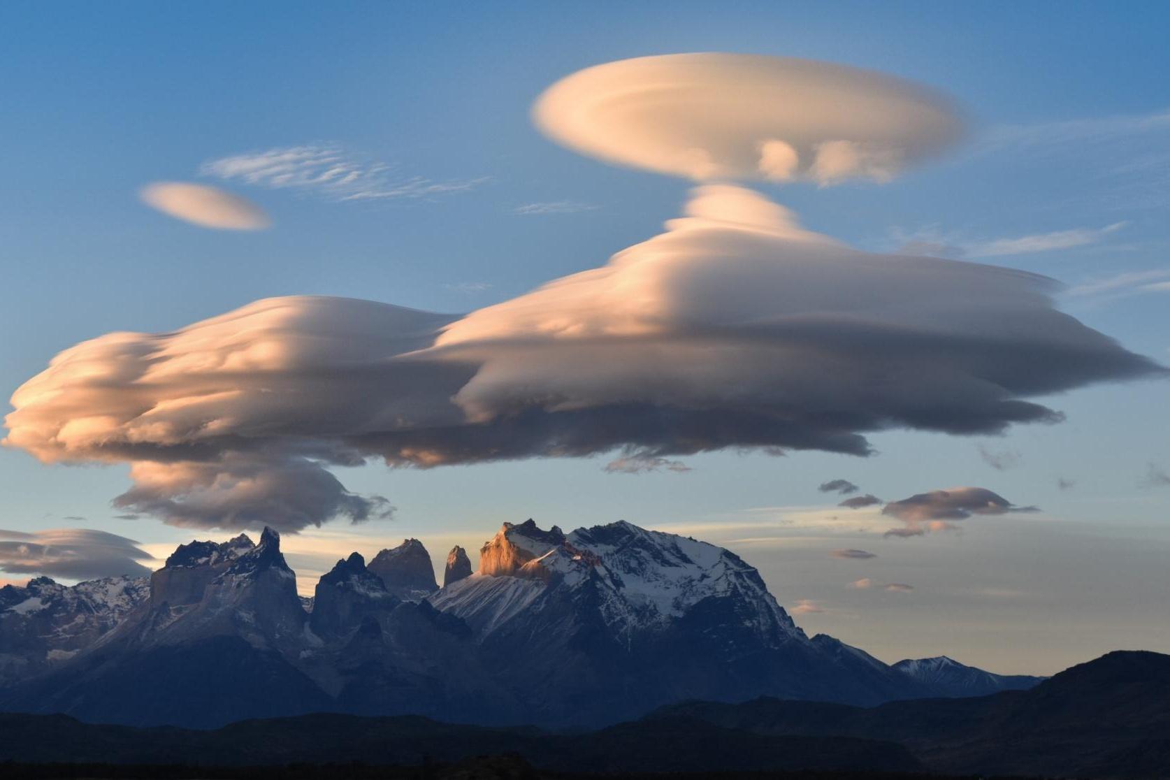
Lenticular clouds above Torres del Paine National Park, Chili. Marc Thunis / Unsplash
Is it a UFO? No, it’s a lenticular cloud, also known as a lens cloud. Such clouds don’t move, even in strong winds. How does that happen? The higher air is, the colder it is. When it cools, the moisture it contains transforms into water drops. It’s these drops that form clouds. Thus, a warm air current cools moving up a mountain, creating a cloud.
Learn more about lenticular clouds
Virga clouds

Virga and rainbow. NOAA / Unsplash
Surely, you have observed how sometimes streaks “hang” from under the clouds — this is a so-called virga, which can appear under cumulonimbus clouds, so it is also called virga clouds. This is the same rain, but it evaporates before reaching the surface of the earth. The reason for this is low ambient humidity. That is, dry air in the way of drops tends to saturate with moisture and "absorbs" them.
Mammatus clouds
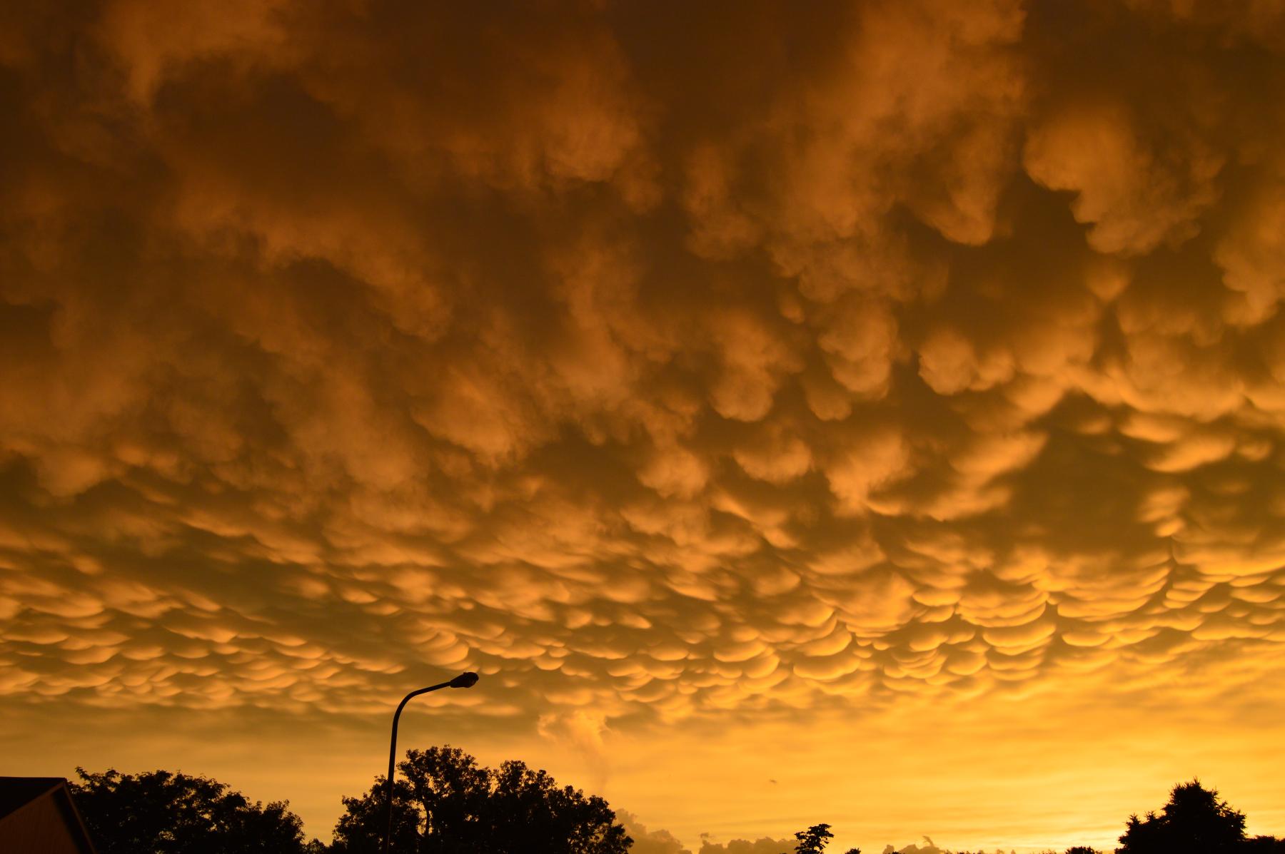
Mammatus clouds at sunset. John Dame / Unsplash
Mammatus clouds are not clouds in the traditional sense. These are small ‘pouches’ that appear on the bottom of cumulonimbus clouds. They can also form on other types of clouds, but only if but only if processes in them are similar to cumulonimbus clouds.
Learn more about mammatus clouds
Wave clouds

Wave clouds. Photo: Amy Christie Hunter via Cnn.com
Some natural phenomena are so rare that not everyone has a chance to witness them. Even more thrilling, sometimes these phenomena can be caused by trivial, well-known processes. For example, wave clouds, a rate type of cloud that looks exactly as it is called — in the form of swirling air, very similar to sea waves that come one after another.
Explore the different types of all the main weather phenomena:
Text: Windy.app team
Illustration: Valerya Milovanova, an illustrator with a degree from the British Higher School of Art an Design (BHSAD) of Universal University
Cover photo: NOAA / Unsplash
Latest News
Professional Weather App
Get a detailed online 10 day weather forecast, live worldwide wind map and local weather reports from the most accurate weather models.
Compare spot conditions, ask locals in the app chat, discover meteo lessons, and share your experience in our Windy.app Community.
Be sure with Windy.app.


