User guide to Weather Map in Windy.app
The Wind and Precipitation map is the main feature of the Windy.app that you see every day on your Home screen. In many ways, the app looks the way it does, thanks to it. However, the map is not just a map showing wind direction and speed. It has many other useful features. Learn how to use them to get more out of the map.
1. Learn to identify wind speed by color
The wind on the map is colored a certain color from blue to purple. Yes, these are the colors of the rainbow just in a slightly different order: blue — little wind, green to red — more wind, purple — too much wind.
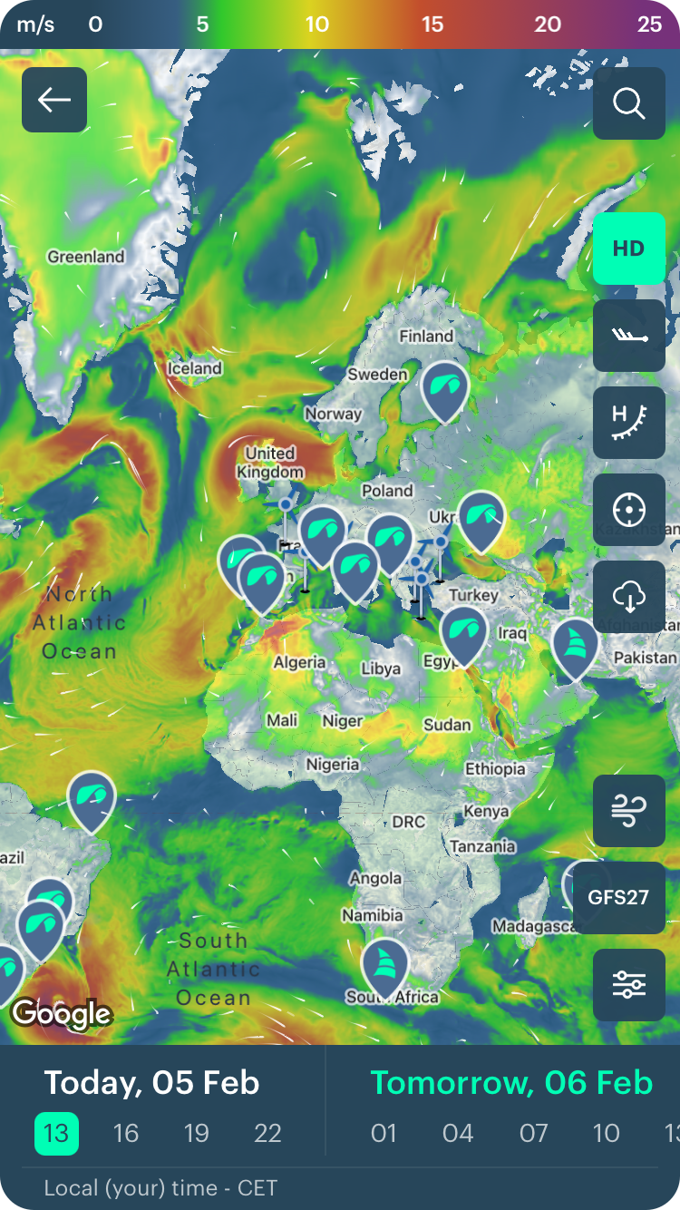
Just look at the map to determine how much wind is now in some particular part of the world. On the calendar, change the day to see where and what the wind will be tomorrow, the day after tomorrow and the next 10 days. The forecast frequency is 3 hours.

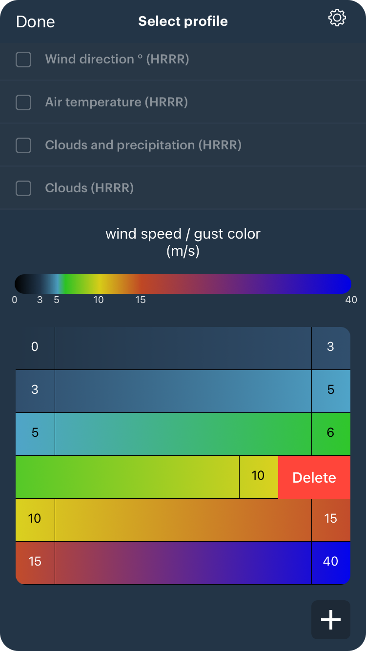
2. Customize the colors of the map
Yes, you can easily customize the wind map. To do this, click on the color scale, then remove or add color to fit specific wind speed values.
Read complete guide to Windy.app customization.
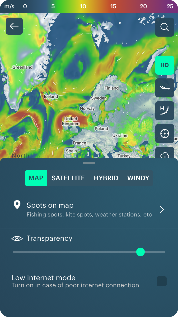
3. Adjust the general view of the map
You can select: map, satellite, or hybrid view and adjust the transparency. Make the map even more personal.
4. Learn not only wind direction and speed but also wind gusts
Gusts are a brief increase of the moving air velocity, usually for no more than 20—30 seconds. The higher the speed, the higher the gusts. Click on the wind icon to activate the feature.
There also is a lesson about wind gusts in the Windy.app Meteorological Texbook. Don't miss it.

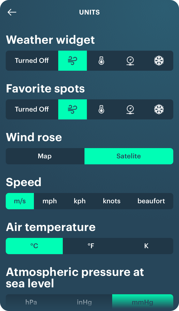
5. Change units of measurement
If you live in the U.S., you're used to miles per hour, not meters per second, which is accepted in Europe. Or vice versa. The following units of wind speed are also available to you in the app's general Settings (Home screen > Main menu bar > Settings > Units): kilometers per hour (kph), nautical knots (knt), and the beauforts (for yachting).
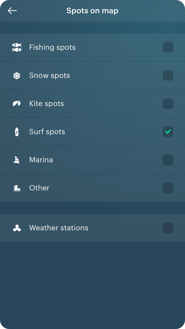
6. Find the sport you need
The Windy.app contains tens of thousands of thematic spots worldwide which we have divided into the following groups: fishing, winter sports (ski resorts), kitesurfing, surfing, marinas (yachting ports), and other important spots for active recreation.
To faster find the sport you need, select one or more types in the map's Extra Settings. Other types of spots will not "clutter up" the screen.
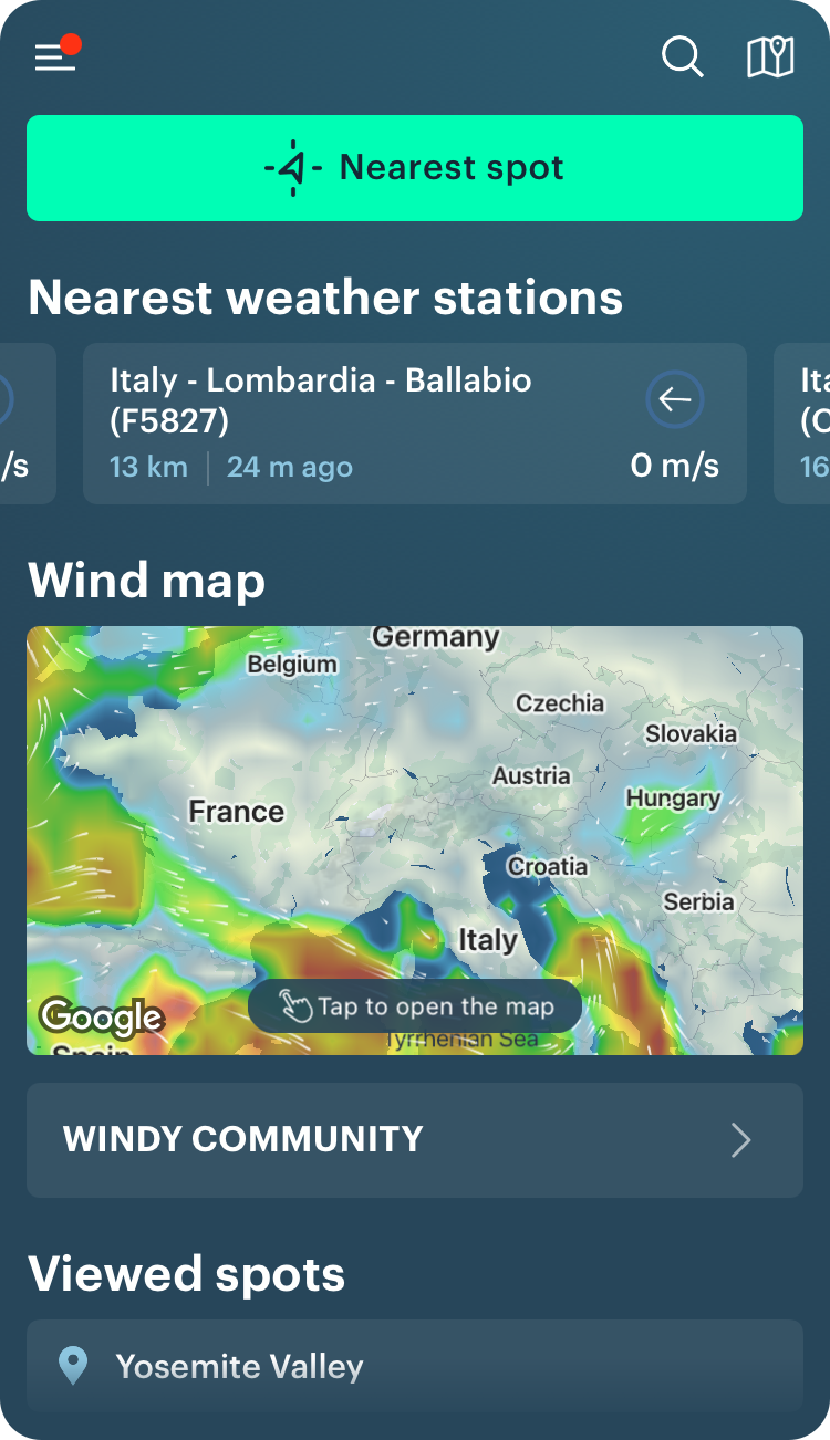
The map also has weather stations — the main source of weather data collection. It is also a type of spot in the app.
7. Add a spot to your Favorite spots so you do not have to search for it anymore
To do this, click on the spot, then on the Star icon on the window. The spot will appear in the Favorite spots on the Home screen of the app.
8. Find out the wind and weather forecast for any point on the map
This is just an incredible feature that not all users know about. Yes, for absolutely any point on the map. You can also make this point a spot and save it in Favorite spots.

9. Activate Wind barbs
It is just a familiar format for displaying the wind field for any sailor. That's how they were drawn on the maps before, and so many people are used to seeing them.
In the Windy.app wind barbs are located in the nodes of the weather model grid — points on the map where the weather is predicted. This excludes interpolation (forecast errors) — the forecast is as accurate as possible. It's updated every three hours.
Learn how to read wind bards in Windy.app blog.

10. Track regional weather changes via Fronts and Isobars features
It may be the strong winds, rains, and thunderstorms, mists… With this feature, sailors could be ahead of it. Atmospheric Fronts significantly improve the safety of sea trips. And Isobars help to know what the general weather situation is like. Learn more about cold and warm fronts.

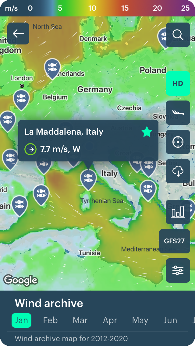
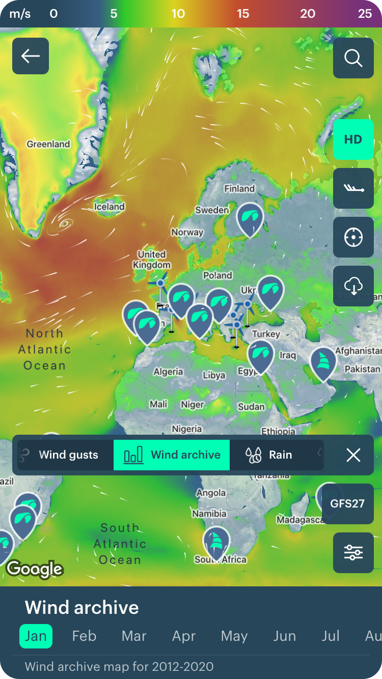
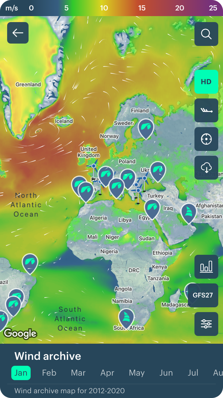
11. Check out the Wind Archive
In Windy.app there is a feature called Weather archive (Weather history), as well as a Detailed weather archive. On the Wind map, it shows the calculated average wind speed for each month for the past 9 years from 2012 to 2020.
It helps you to know what the wind was at a certain point on the map or region.
12. Change the weather model to a more appropriate one
There are over 10 global and regional weather models in the application. But not all of them will give you the forecast you need. Learn more about the models and learn how to choose them correctly — this will improve the quality of the forecast you get. To choose the model, click on an icon with its name, for exampe, GFS27 on this screen shoot.
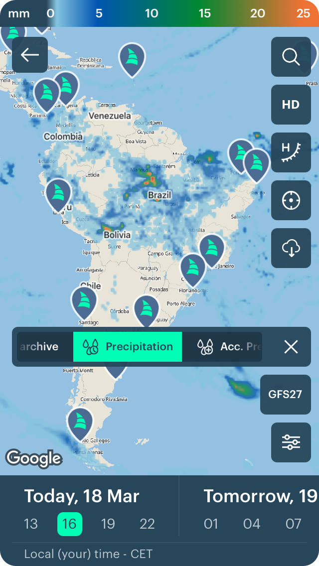
13. Get to know precipitation
The wind layer is always set by default on the map. Change it to precipitation to see where and when it will rain or snow.
At the top of the screen is a color bar — the same as on the Wind map. But it does not show the wind speed, but the amount of precipitation in millimeters (mm) or other units that you can set in Settings. The amount of precipitation can also be set visually by the color — from blue to magenta.
Heavy rain is 15—50 mm (0.5—1.9 inches, in) in 12 hours, heavy snowfall is 7—20 cm (2.7—7.4 in) in 12 hours.
For precipitation, the forecast is available for the next 10 days in a 3-hour step.
14. Get to know accumulated precipitation, as well.
There is also another kind of precipitation called "accumulated". It is the amount of total precipitation in a given period of time. It is used to locate flood potential over urban or rural areas, estimate total basin runoff, but also for outdoor activities.
For accumulated precipitation, the forecast is available for the next 12 hours, 24 hours, 3, 5, and 10 days. The same is true for the past. This way you can find out what the weather was like on the spot up to 10 days ago. Learn more about weather history for weather forecasting.

15. See every detail of the map
To do this, activate the HD map feature. The map will become 4x times more detailed.
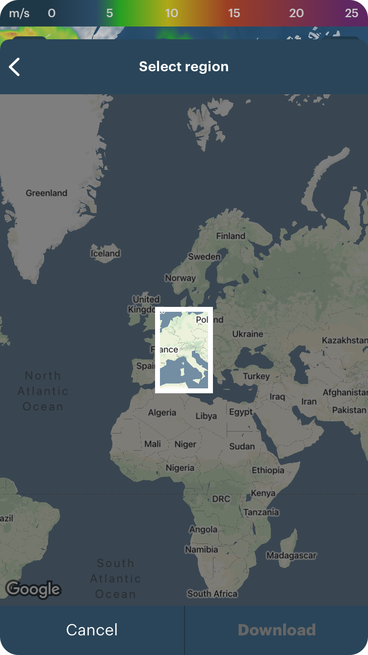
16. Save the offline wind forecast for a part of the map
You will definitely need Offline mode feature in situations where you do not have access to the Internet. Do to so, click on Download icon on a map.
17. Find yourself on the map
If you get lost on the map, click on the target icon to find your location. Before doing so, in your phone settings, allow Windy.app to detect your geolocation.

18. Return to Weather Map from the different places in the app
The map is always visible in four different places in the app: on the Home screen, on the spots screens, on Weather archive (Weather history) screen, which you can find for every spot, on each Weather station screen. Just click on an icon to return to the map.

19. Use Weather Map on the Windy.app website
There is the same Weather Map on the Windy.app website, which you can use together with your app in case you need larger screen or some additional features like Sailing Routes on the map, which you can't get in the Windy.app for iOS app. Learn how to use Weather Map on the website in a separate guide.

Text: Windy.app team
Cover photo: Unsplash
You will also find useful
How to read contour lines on weather maps. A brief manual
How to read a weather map like an expert. Wind, precipitation, fronts, and more
How to make the most out of the Weather Map in Windy.app
Latest News
Professional Weather App
Get a detailed online 10 day weather forecast, live worldwide wind map and local weather reports from the most accurate weather models.
Compare spot conditions, ask locals in the app chat, discover meteo lessons, and share your experience in our Windy.app Community.
Be sure with Windy.app.


